Guides Scale in Aerial Images

Scale in Aerial Images

Scale is the ratio of the distance between two points on an image to the actual distance between the same two points on the ground. It is an important factor when describing and understanding vertical aerial photography. Knowing the scale of the photo under examination, can affect how you perceive or interpret what appears in the image. Scale also allows features in the image to be measured.

A small-scale colour aerial photo of Glasgow. Grids of streets are visible across the image, interspersed with green parks to the left, and with extensive green spaces in the top right corner. A river runs along the bottom edge.

Small-scale and large-scale aerial images

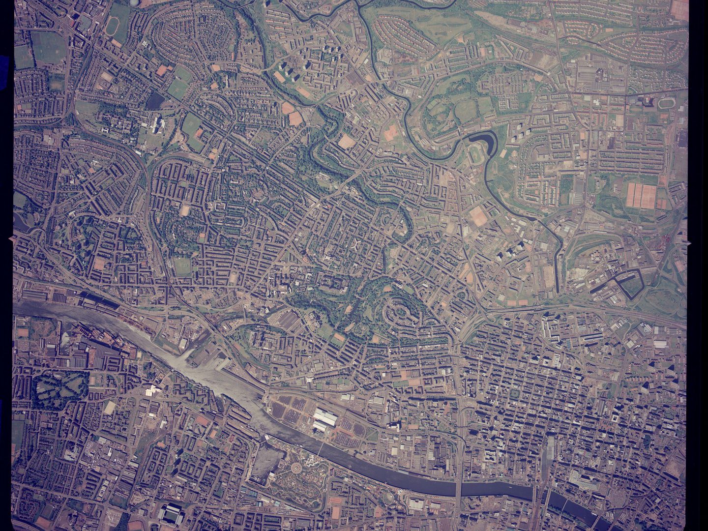
Scale in aerial photography is presented as a ratio, like 1:24000 or 1:50000, in the same way that it appears on maps. If an image like the one above has a scale of 1:24000, this means that 1 centimetre in the image represents 24,000 centimetres (or 240 metres) on the ground. This is a small-scale photo showing central and west Glasgow, and beyond - it covers a large area of ground but doesn't show a lot of detail.

A medium-scale colour aerial photo of Glasgow. The river from the previous image now occupies the centre, running diagonally from top left to bottom right. There are industrial buildings on the riverbank, with houses and parks further away.

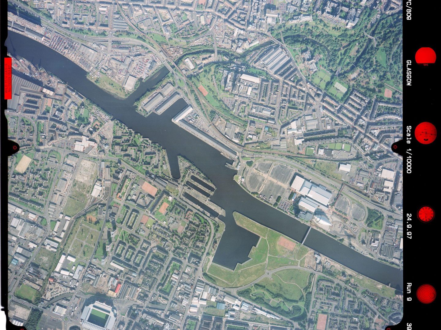
This image shows a portion of the same area as the first photo, roughly equal to the lower left quarter. Now all that is visible is the University of Glasgow at the top right, across the docks to Ibrox Stadium at the bottom left. That is because it is a larger-scale image at a ratio of 1:10000. Although the area covered is smaller, the amount of detail that is visible is greater.

A large-scale black and white aerial photo of Glasgow. The river from the previous images now occupies almost the whole frame. At the left side, ships are clearly visible docked next to the river. There are blocks of flats in the bottom left corner.

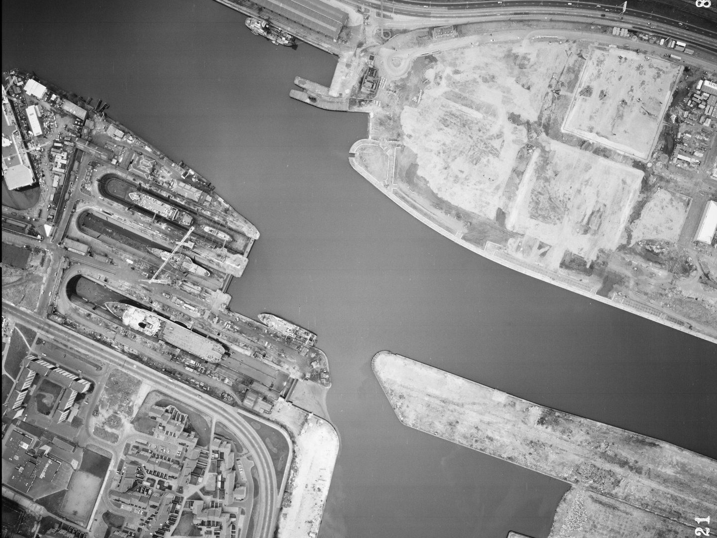
This final image is at an even bigger scale of 1:3000. While 1 centimetre was the equivalent of 240 metres on the ground in the first image, here 1 centimetre represents just 30 metres on the ground. It only covers a small area of the docks visible in the previous two images, but in great detail. At this scale, cars and even people are clearly visible.

Focal Length

The focal length is the distance between the camera lens and the film. The focal length of the lens affects the scale of the image captured. A camera with a long focal length lens will produce images which look as if they have been taken close to the ground. Conversely a short focal length lens will produce smaller scale photographs which can look as if they have been taken at altitude.

More Guides

A greyscale drawing of a plane flying above 6 trees. A triangle pointing straight down from the plane indicates the area covered by a vertical aerial photo. A triangle pointing down at an angle indicates the area covered by an oblique aerial photo.

Types of Aerial Images

The capture of aerial photography has most often been been a systematic process. Learn to identify each type and see how they differ.

A large-scale black and white aerial photo of Glasgow. The river from the previous images now occupies almost the whole frame. At the left side, ships are clearly visible docked next to the river. There are blocks of flats in the bottom left corner.

Scale in Aerial Images

Aerial photographs come in a range of different scales. Learn what impact different scales have on understanding aerial photographs.

A black and white aerial photo of Rosyth docks. The image is busy and confusing. The sea is at the bottom edge with some ships in dry docks or tied up at piers. There are numerous industrial buildings and roads. At centre right is a small woodland.

Interpreting Aerial Images

Learn more about how to analyse and understand aerial imagery to make the best use of it for your research needs.

A blue support for large rolls of film with a black winding handle. A black and white aerial film is being supported on the winder. It is lit from below with a white light.

How to Order Undigitised Images

Not all NCAP collections are digitised and shared on NCAP's Air Photo Finder. Using the historical finding aids or a paid search service, you can request images for scan-on-demand.

An Ordnance Survey map of the Orkney Islands. Islands coloured white are surrounded by a sea represented in blue. The map has been annotated with coloured lines showing where aerial photos were taken.

How to use OS Finding Aids

Finding aids show the geographic coverage of photographic reconnaissance missions in our collection.

A colourful map of a rural part of north Germany (including Wilhelmshaven), with blue representing water and green for woodlands. A straggling line of black boxes marked with numbers from P9 to P50 indicates where a reconnaissance plane took photos.

How to use Second World War Finding Aids

Learn how to use digitised original plotting information, finding aids, from the Second World War. This will allow you to locate and identify historical military aerial imagery of your areas of interest.