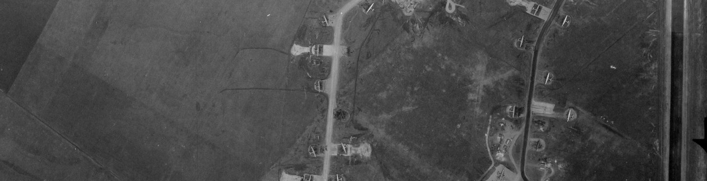
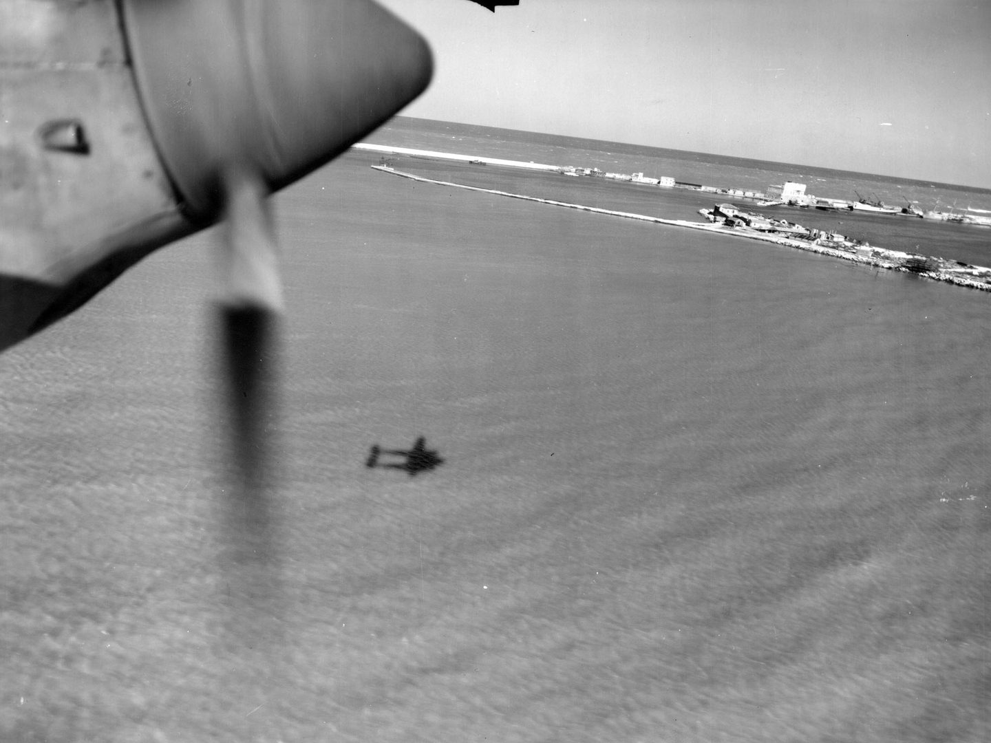
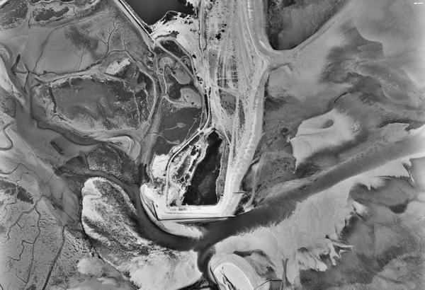
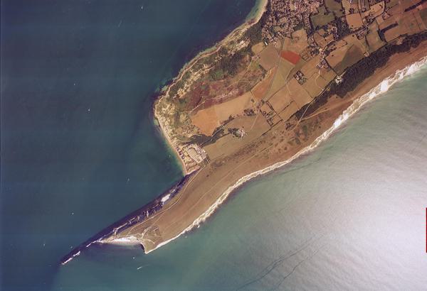
Collection: MAPRW, Sortie: 15SG/L/0102, Frame: 3045 (28 May 1945)
Consolidated B-24 Liberators at Torretta Airfield near Foggia in Italy
Collection: MAPRW, Sortie: 15SG/L/0102, Frame: 3045 (28 May 1945)
Mediterranean Allied Photo Reconnaissance Wing
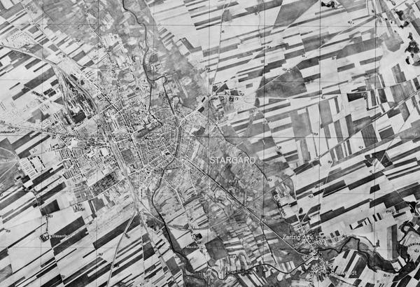
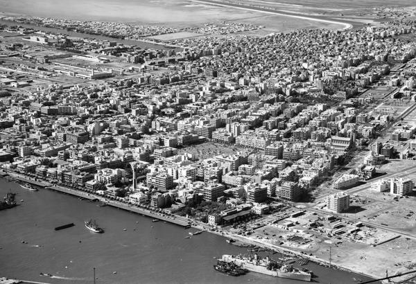
The Mediterranean Allied Photo Reconnaissance Wing (MAPRW) Collection contains c.150,000 aerial photographs taken during the Second World War by Allied units operating from North Africa and Italy. The MAPRW was the reconnaissance and intelligence arm of the Mediterranean Allied Air Forces during the latter stages of the Second World War. It was initially based in North Africa and then, as the war progressed, southern Italy.
History
The MAPRW had its origins in the Casablanca Conference of 14-24 January 1943. There, Winston Churchill, Franklin D. Roosevelt, and Charles de Gaulle met to discuss the future of Allied operations in the Mediterranean following the successful invasion of French North Africa the previous year.
These discussions led to the creation of the Northwest African Photo Reconnaissance Wing in February 1943 as part of the existing Mediterranean Allied Air Forces. The Wing was initially under the command of Colonel Elliot Roosevelt, the son of the American president.
In November 1943, the specifically British 336(PR) Wing was established as part of the overall North-west African Photo Reconnaissance Wing, and a month later the whole was renamed the Mediterranean Allied Photo Reconnaissance Wing. Throughout 1943 and 1944, the MAPRW became a major provider of target information for raids throughout the Mediterranean region.
Notable MAPRW activity included preparations for Operation Tidal Wave – the dramatic but ultimately ineffective raid by American bombers on Romanian oil refineries at Ploiești – and reconnaissance of the missile testing range at Blizna, Poland where V2 rocket development took place.
Acquisition
After the Second World War, although much of the MAPRW print library was gifted to the Italian government, a significant portion was transferred to the British School at Rome, before passing to the Pitt Rivers Museum in Oxford. In the early 1980s, the material was handed to Keele University in its capacity as an official Place of Deposit, where it joined the Allied Central Interpretation Unit Collection. In 2008 the collections were transferred to the Royal Commission on the Ancient and Historical Monuments of Scotland (now Historic Environment Scotland) and became part of the new National Collection of Aerial Photography.
Scope
The MAPRW Collection – taken by British (RAF), American (USAAF) and South African (SAAF) units between 1942 and 1945 – mostly contains photographs taken throughout the Mediterranean, although coverage also extends into France, Germany, and Eastern Europe.
| Geographical coverage | ||
|---|---|---|
| Albania | Germany | North Macedonia |
| Algeria | Greece | Poland |
| Belgium | Hungary | Romania |
| Bosnia & Herzegovina | Italy | Serbia |
| Bulgaria | Luxembourg | Slovakia |
| Croatia | Moldova | Slovenia |
| Czechia | Montenegro | Switzerland |
| France | Netherlands | |
collection contents
The Collection is made up of:
- c.150,000 vertical and oblique aerial photographic prints
- associated paper sortie plots
Air Photo Finder
A small amount of this collection has been digitised and is available to view on the Air Photo Finder.
Subscriptions
Finding aids are available for this Collection and can be examined with a subscription.
ArchivesSpace
The whole Collection is accessible via our Paid Image Search and Search Room services. Visit ArchivesSpace to learn about the Collection hierarchies.
IN THIS SECTION

Allied Central Interpretation Unit
The ACIU Collection is home to 5.5 million photographic reconnaissance images taken during the Second World War, providing a visual record of occupied Western Europe.
British Aerial Survey Firms
NCAP has extensive holdings of photography taken by several important British aerial survey companies over a period of 50 years.
Defence Geographic Centre
The DGC Collection contains aerial photographs of locations around the world, originally used to create maps for issue to British and Commonwealth forces.
Directorate of Overseas Surveys
The DOS Collection provides a unique historical perspective, recording the changing landscapes of much of the Commonwealth throughout the 20th century.
Environment Agency
The EA Collection is a valuable record of the quickly changing coastal landscapes of the south-east of England, from Bournemouth round to Gravesend.
German Air Force
The GX Collection contains photos taken by the Luftwaffe during the Second World War, which were then used for intelligence purposes during the Cold War.
Joint Air Reconnaissance Intelligence Centre
The JARIC Collection holds millions of Cold War reconnaissance images and forms unique record of British interests and activities.
Millennium Mapping
NCAP is home to the Getmapping and UK Perspectives Collections, two parallel projects to create a visual record of the UK at the turn of the millennium.

National Archives and Records Administration
The NARA Collection contains worldwide imagery digitised as part of a partnership with the United States National Archives and Records Administration.
Natural Environment Research Council
The NERC Collection contains over 27,300 aerial photographs taken around Europe for research purposes on behalf of the British Geological Survey.
Scottish Office Air Photographs Unit
The Scottish Office APU Collection provides a remarkable, 100-year record of Scotland’s changing landscapes from 1.5 million aerial photos of Scotland.