Aerial photography and the Second World War
The early days of the Second World War
Photographic reconnaissance was an incredibly important tool throughout the Second World War as it enabled the gathering of vital intelligence. Over 1,000 British, French and German aerial photographs that were taken in the early days of the war are a part of the NCAP collection. These images, and the following tens of millions that were taken over the course of the war, played a key part in the tactics and approach used on both sides. The NCAP archive holds millions of images that were taken between 1st September 1939 and 2nd September 1945.
Throughout the war Allied missions were flown by the British Secret Intelligence Service and Royal Air Force, and the French Deuxieme Bureau. The NCAP collection mainly holds material created by Allied forces, however there is some Axis created imagery within the collection. What the NCAP collection reveals is that just as Allied Forces undertook aerial reconnaissance of land under Axis control, the Axis powers undertook aerial reconnaissance of land under Allied control.
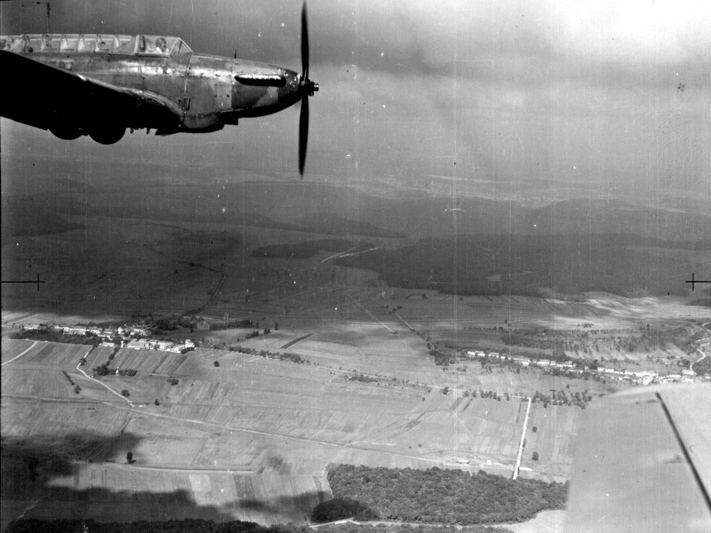
A single-engine Fairey Battle aircraft, photographed from the cockpit of another aircraft; Collection: ACIU, Sortie: AASF/226/20/09/1939, Frame: C0003 (20 September 1939)
How imagery was captured
Aerial photography was primarily captured through use of specially adapted planes, which had armaments removed to make space for the often bulky photographic equipment they needed to carry. These adaptations varied in sophistication, as over the course of the war the equipment, technology, and understanding of the processes required to get the best imagery possible advanced.
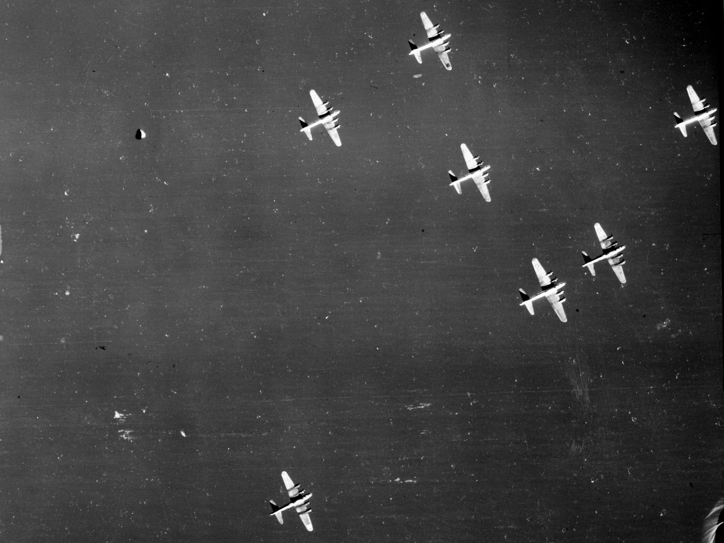
Boeing B-17 aircraft in flight over water; Collection: JARIC, Sortie: 106G/3280, Frame: 3002 (1 October 1939)
Pilots, often flying alone, were required to operate the photographic equipment, whilst also piloting the aircraft. Of particular importance was awareness of their course and altitude - worked out to be as unobtrusive as possible to avoid any chance of being spotted and drawn into conflict with the enemy – as well as to avoid freezing and condensation on the equipment, as this would impact image quality.
A vast infrastructure developed to facilitate the movement of films from planes to processing labs, so that they could be in the hands of photographic interpreters as soon as possible. The speed of this process was constrained by return flight times, chemical processing times, travel time and the time needed to analyse the imagery.
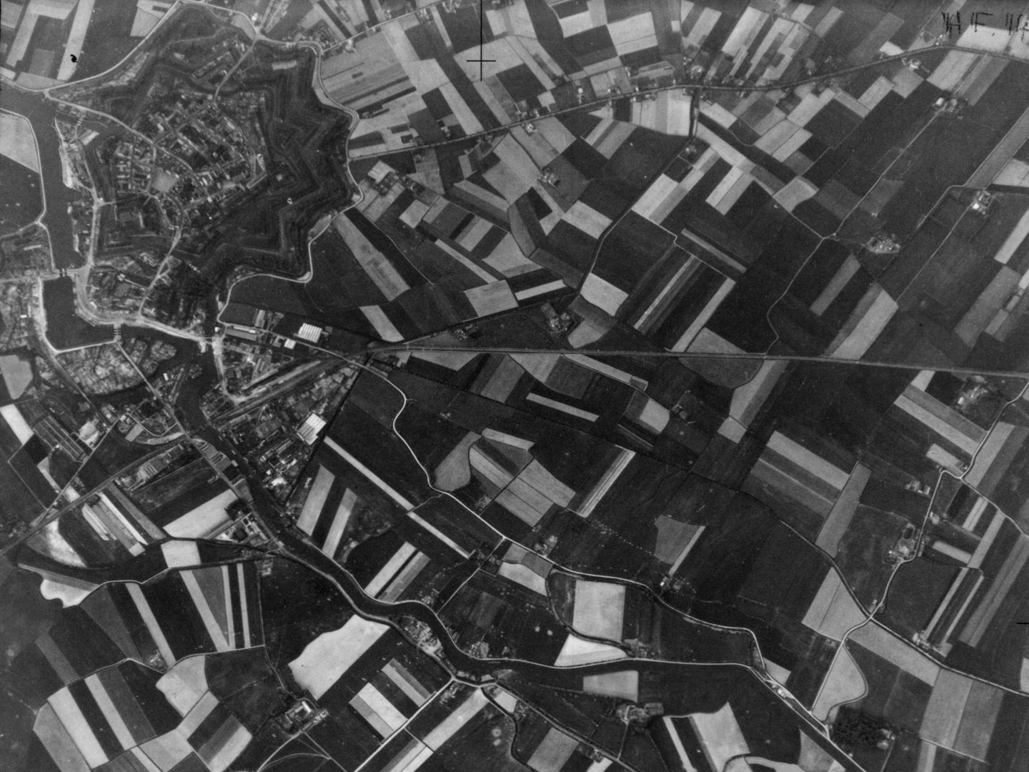
Western end of the Dunkirk perimeter, held by French troops; Collection: ACIU, Sortie: HAA/0032, Frame: 0240 (31 May 1940)
The role of aerial photography
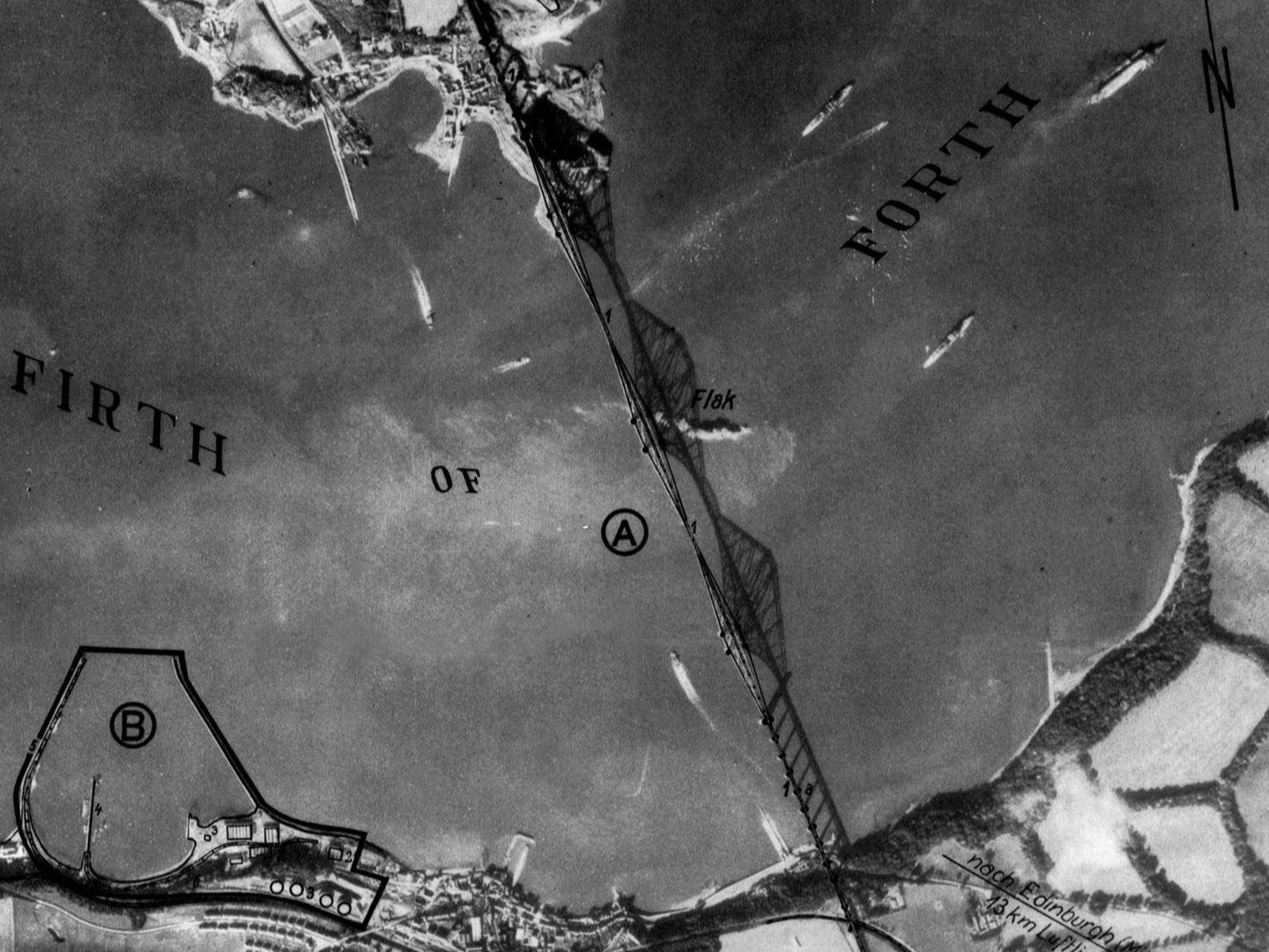
When coupled with the skills of photographic interpreters it was possible for military personnel to use these unbiased primary sources to draw out information regarding the planning, movement and plans of the enemy. Information that might be shown in aerial photographs included the location, placement and numbers of troops, locations of infrastructure like bridges and ports, areas of population and geographic features. What was also notable was any change to these things. As a result, repeat sorties over the same area were often ordered.
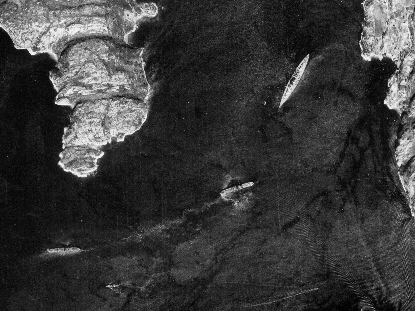
German battleship Bismarck in a fjord in Western Norway; Collection: ACIU, Sortie: N/0183, Frame: 0660 (21 May 1941)
These images are revealing in that they give a sense of the scale of the war. A key advantage during wartime is that aerial photography provides information that is unbiased – and as such, when prepared and analysed, they could give the privilege of time and understanding of the lie of the land, in order to facilitate considered, evidenced based decision making.
Read more about collections relating to the Second World War in our Image Collections pages.
Rowan Berry, NCAP Sales Admin Assistant