A Brief History of Aerial Photography
Aerial photography has its roots in the eighteenth century, when the first experiments in the chemical processes that would lead to photography took place and, separately, balloons began to be used for military observation. In 1858, the first true aerial photograph was taken. In the following years, aerial photography has transformed from laborious, individually taken black and white prints to incredibly detailed digital images captured hundreds at a time by modern drones.
Balloons, Kites, Pigeons
The very first aerial photograph was taken in 1858 from a balloon by French photographer Gaspard-Félix ‘Nadar’ Tournachon, above the French village of Petit-Becetre. Nadar’s earliest photographs no longer exist, so the earliest aerial photograph that survives shows Boston in 1860, taken by James Wallace Black and Samuel Archer King.
Other early experiments in aerial photography involved attaching cameras to kites and rockets. Perhaps the most remarkable early experiment in aerial photography came when German Julius Neubranner attached tiny cameras to pigeons. The resulting photographs were popular with the public but somewhat erratically taken.
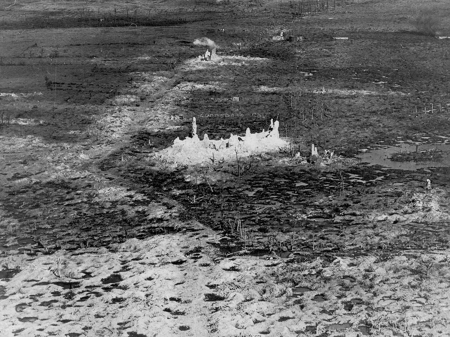
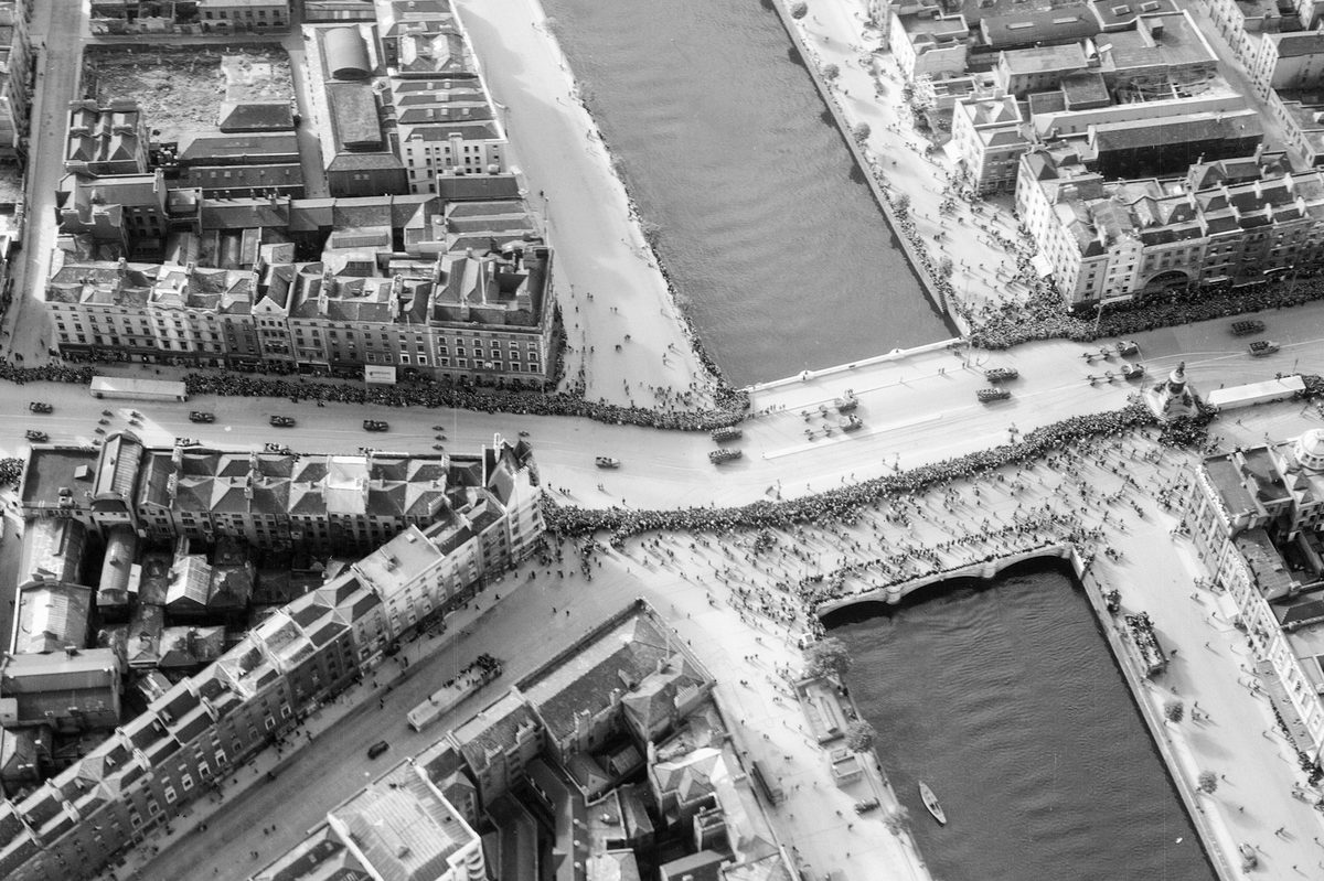
The destruction of Zonnebeke, Belgium, during the First World War
First World War
Around the same time as Neubranner’s pigeon experiments, the Wright Brothers managed the first sustained, controlled, powered heavier-than-air manned flight. It quickly became apparent the most effective way of taking aerial photographs would be from aeroplanes. The demands of the First World War rapidly accelerated aerial photographic equipment and techniques.
At the onset of war, the French, German and British air forces all had aircraft equipped with cameras for aerial reconnaissance. Royal Flying Corps officers Frederick Laws and John Moore-Brabazon pioneered the development of purpose-built aerial cameras. They also developed the stereoscopic techniques which allowed the viewing of pairs of aerial photographs with a 60% overlap in three dimensions.
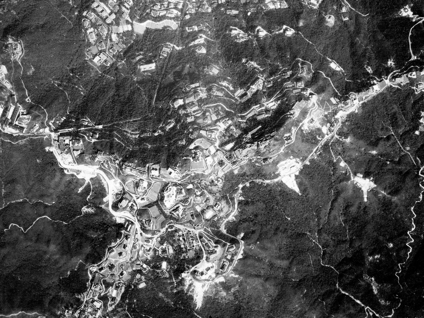
Hong Kong Island, Hong Kong; Collection: DGC, Sortie: PEGASUS/RN/H/0025, Frame: 0017 (14 November 1924)
Second World War
Between the wars, aerial photography came to be used increasingly for survey and mapping purposes. Although military aerial photography was somewhat neglected, the beginning of the Second World War prompted more rapid developments in aerial photographic technologies.
Australian inventor and aviator Sidney Cotton was instrumental in pioneering the use of small, fast aircraft such as the Supermarine Spitfire for aerial photography. With guns and radios removed – to accommodate extra fuel and cameras – they could fly higher and faster than intercepting aircraft. Newly developed heating systems stopped cameras freezing and lenses fogging over. Techniques for interpreting aerial photographs underwent rapid advances thanks to the work undertaken at RAF Medmenham.
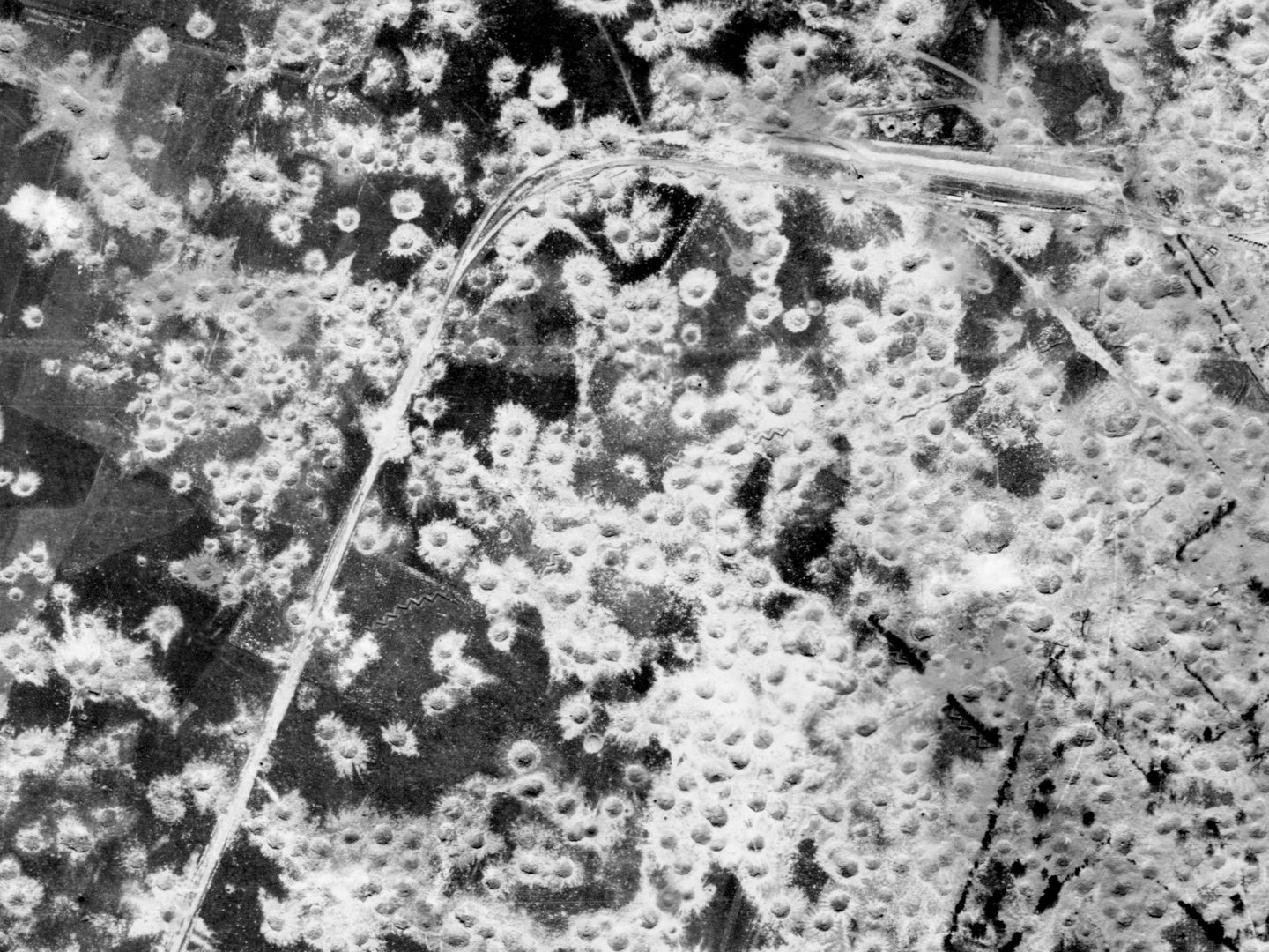
The results of bombing against a V2 ‘heavy site’ at Siracourt, France, 06 July 1944; Collection: ACIU, Sortie: 106G/1268, Frame: 4091 (06 July 1944)
Post-1945
After the Second World War, aerial photography was used for a wide range of civil and military purposes. Governments surveyed their own countries while colonial governments surveyed overseas territories for mapping and administration. Numerous aerial survey firms sprung up to service these needs. Aerial photography was used extensively for military reconnaissance throughout the Cold War. The UK government accrued millions of images of British territories and areas of interest. However, such activities were not without risk. Escalating tensions throughout the Cold War and the shooting down of an American U-2 spy plane over the Soviet Union on 1 May 1960, marked the end of US photography of the Soviet Union by manned aircraft and was replaced by early, but less detailed satellite imaging.
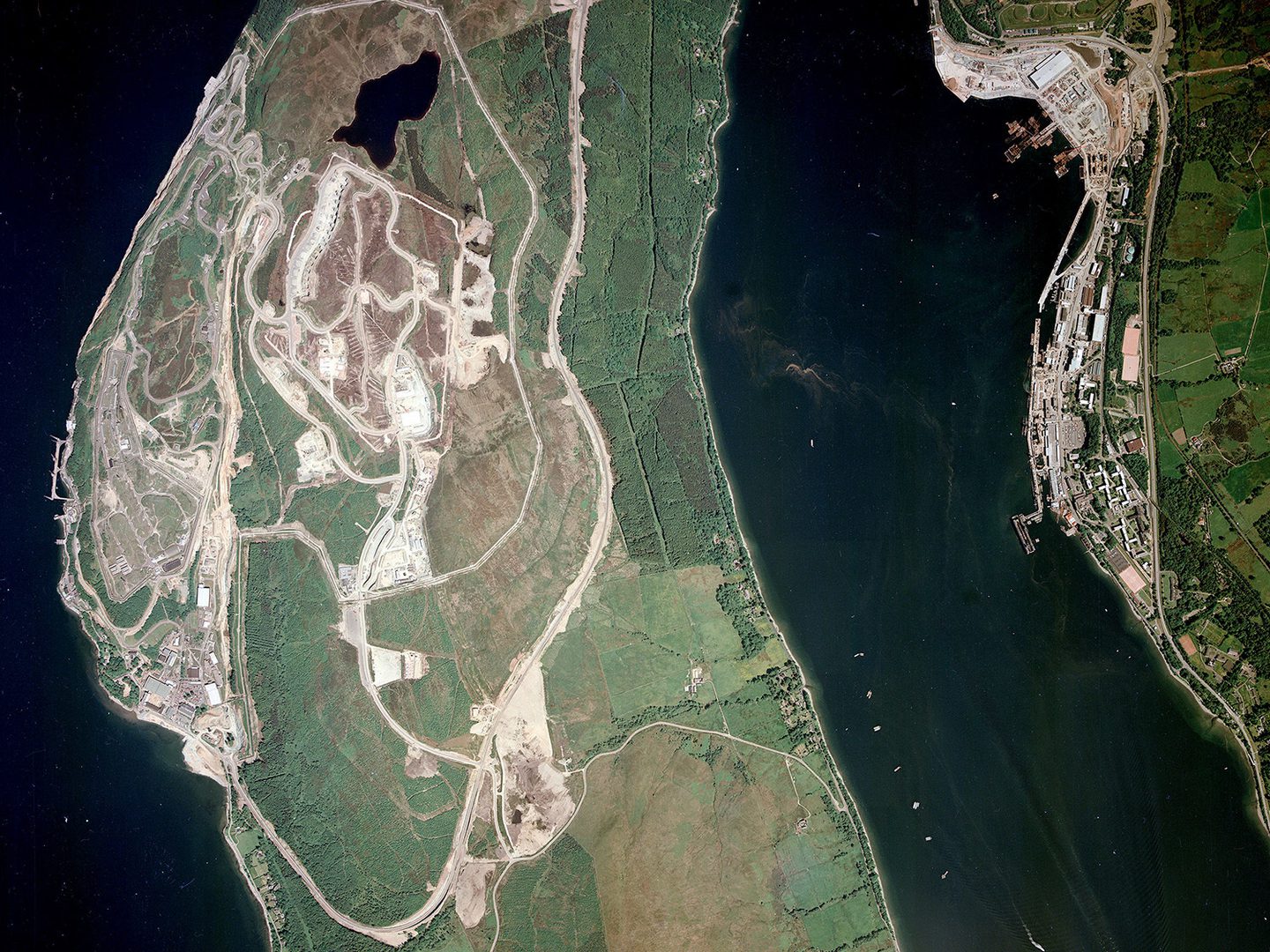
Royal Naval Armaments Depot Coulport developed during the Cold War; Collection: Scottish Office, Sortie: ASS/51488, Frame: 0038 (14 June 1988)
In the 1980s, more expensive colour film began to be used, and in the 1990s aerial photography started the shift from analogue film to digital images which would happen slowly over the following decades. Despite the rise of satellite imaging, aerial photography continues to be used for archaeological and environmental surveys, mapping, and reconnaissance.
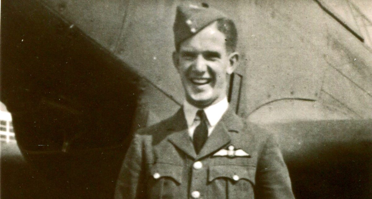
Ben Reiss, NCAP Collections Manager