Cold War Imagery Documents Global Political Events
Reconnaissance during the Cold War
The Cold War marked an era of prolonged political and military tension among major global powers following the end of the Second World War. This period, spanning from 1947 to 1991, was characterised by intense political rivalry between the Western bloc (comprising the USA and NATO) and the Eastern bloc (encompassing the Soviet Union and the Warsaw Pact), with its impact reverberating worldwide.
Aerial reconnaissance played a pivotal role on both sides of the conflict, serving as a crucial tool for gathering intelligence on the activities of opposing forces. The images captured during reconnaissance missions revealed significant details such as construction and land use changes, military installations, and infrastructure developments, offering valuable insights into the dynamics of the Cold War.

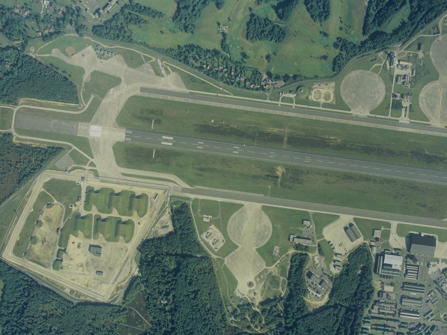
Anti-nuclear protests took place at RAF Molesworth in the 1980s; Collection: AIRBUS Defence & Space, Sortie: GEONEX/0032/90 Frame: 0198 (26 May 1990)
It was often necessary that aerial reconnaissance flights were conducted at high altitudes to ensure that imagery could be captured without interception or detection. However, flying at such heights posed challenges, including the increased likelihood of capturing atmospheric conditions like cloud cover, haze, and fog within the images. Despite these obstacles, valuable intelligence was still obtained regarding territories inaccessible to British and American military aircraft.
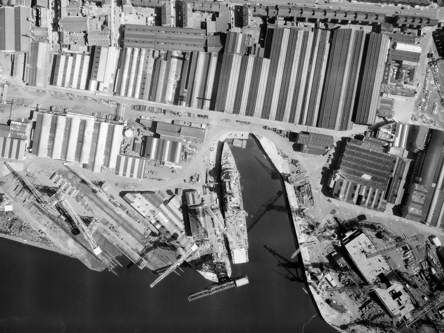
HMS Intrepid can be seen under construction at John Brown's shipyard, Clydebank; Collection: Scottish Office APU, Sortie: MER/040/66 Frame: 0027 (20 July 1966)
The Cold War in the United Kingdom
The UK occupies a strategic position between continental Europe and the North Atlantic, and a variety of installations were built there during the Cold War by the UK and NATO.

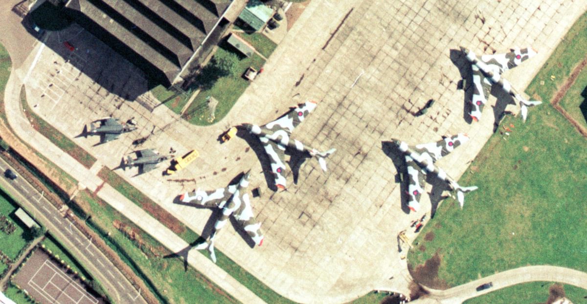
RAF Wittering's V-bomber Operational Readiness Platform, the 4 concrete stands at the east end of the main runway; Collection: AIRBUS Defence & Space, Sortie: GEONEX/0034/90, Frame: 0041 (27 May 1990)
From submarine bases and airfields to military ports and nuclear bunkers, remnants of Cold War construction continue to dot the landscape of the UK to this day. The NCAP collection holds declassified military aerial images showcasing these construction projects, among which are records of, now culturally significant sites such as RAF Greenham Common and RAF Molesworth. These two bases notably housed nuclear cruise missiles, offering poignant glimpses into the era's geopolitical tensions.
Both Greenham Common and RAF Molesworth emerged as symbols of nuclear tensions and became focal points for political protest in the UK. The presence of American-controlled nuclear-armed cruise missiles at Greenham Common led to the establishment of the Greenham Common Women's Peace Camp, while RAF Molesworth similarly fueled protests from peace activists. These sites served as powerful symbols of resistance against the deployment of nuclear weapons on British soil during the Cold War era.
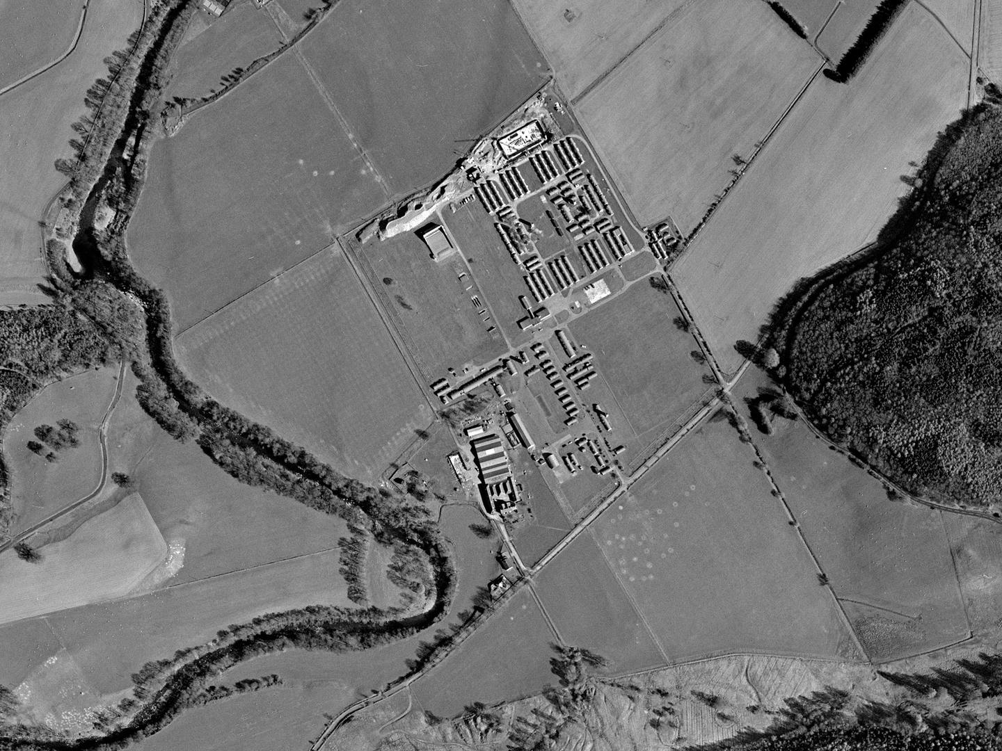
Excavation for a bunker at Cultybraggan’s former military and Prisoner of War camp; Collection: Scottish Office APU, Sortie: ASS/60789, Frame: 0157 (26 April 1989)
project robin
Project ROBIN stands out as a prime example of the tightly knit collaboration between the UK and US in the realm of air intelligence during the Cold War. This joint venture was to address the pressing need for comprehensive reconnaissance over Soviet Bloc and Mediterranean territories.
At its core, Project ROBIN entailed the integration of a formidable US camera system onto a British reconnaissance aircraft. This strategic amalgamation enabled the aircraft to capture long-range photographs with unparalleled precision and detail.
The selection of the Canberra aircraft for this endeavour was strategic. Renowned for its exceptional altitude capabilities, the Canberra possessed the unique ability to fly at heights that enabled the photography of targets deep within Soviet-controlled territory. This attribute was instrumental in ensuring the success of Project ROBIN, as it provided unprecedented access to critical intelligence data.

The shadow of an English Electric Canberra PR Mk.9 photographic reconnaissance aircraft on a sortie to Paderborn, Germany; Collection: JARIC, Sortie: 1PRU/RAF/1246, Frame: 0381 (14 July 1987)
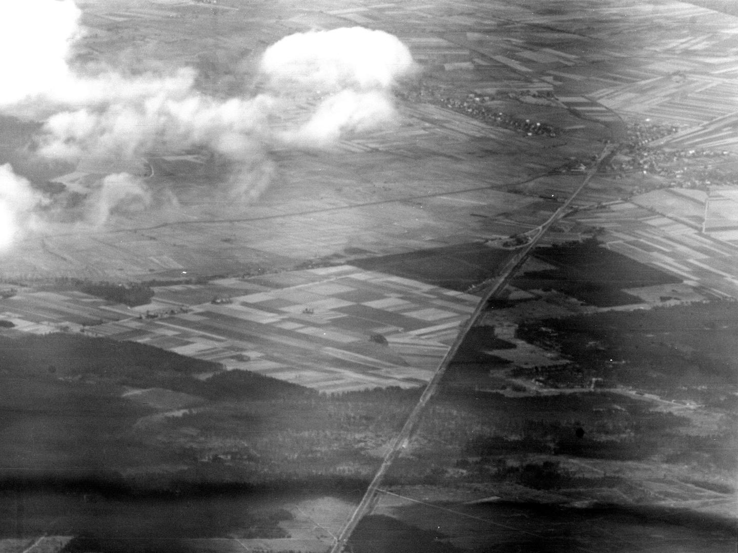
The inaugural ROBIN sortie took flight on April 23, 1954, traversing the British Zone of Occupation between Lubeck and Brunswick. With the camera trained eastward, the mission likely served as an operational equipment test, strategically maintaining a distance of 10 to 18 miles west of the East German border to mitigate potential detection risks.
In its early stages, ROBIN focused on reconnaissance over East Germany, providing invaluable insights into Soviet activities in the region. However, the project's scope expanded significantly. During a pivotal mission flown on December 12, 1956, ROBIN captured photographs of intelligence targets in Syria, Lebanon, and Egypt, showcasing its versatility in gathering vital information beyond the confines of Europe.
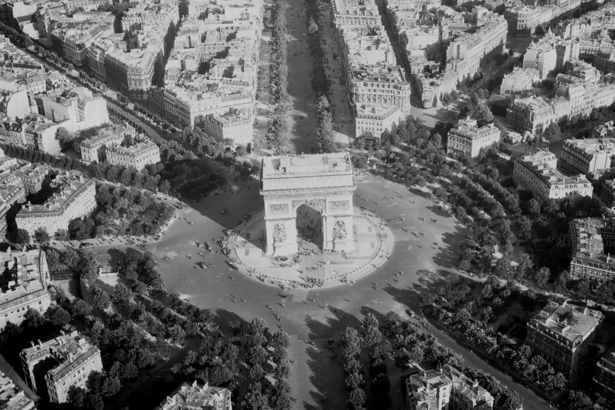
One of the first images taken during Project ROBIN, of Krebsförden in Germany; Collection: JARIC, Sortie: ROBIN/0001, Frame: 1003 (23 April 1954)
The outcomes of Project ROBIN were multifaceted. Not only did it enhance strategic understanding of Soviet Bloc territories, but it also provided critical intelligence on geopolitical developments in the Mediterranean region. In essence, Project ROBIN epitomised the collaborative spirit and ingenuity that characterized UK-US cooperation during the Cold War.
Through innovative approaches and shared expertise, this initiative played a pivotal role in enhancing intelligence-gathering capabilities and bolstering strategic understanding during a tumultuous period in global history.
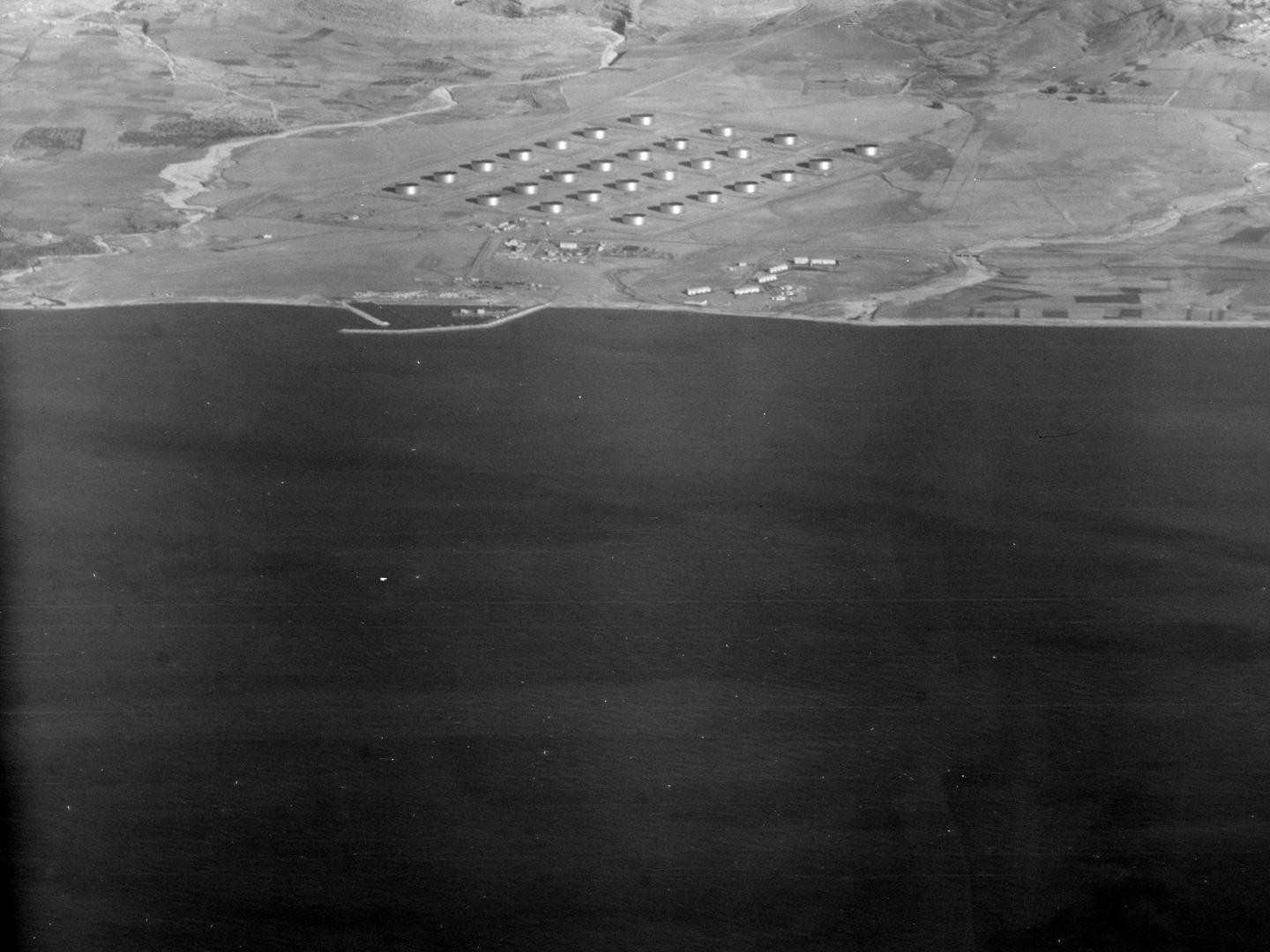
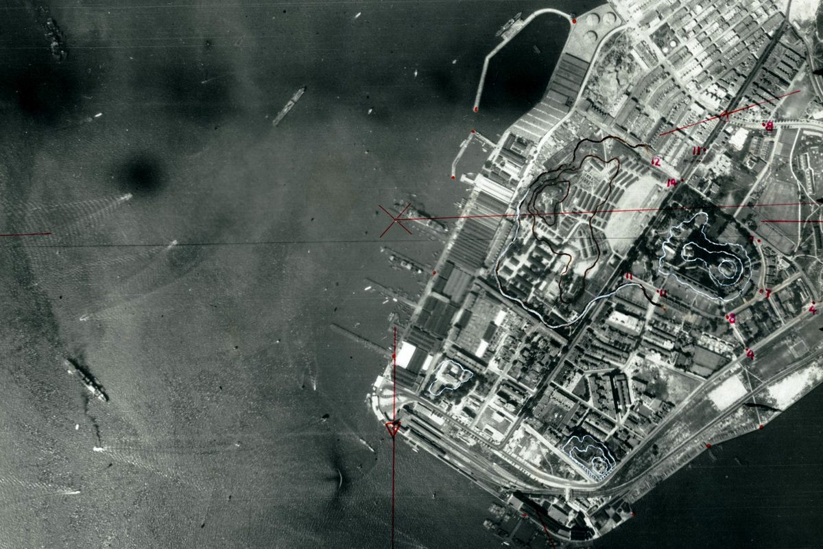
Oil storage tanks in Syria, photographed during a Cold War reconnaissance mission; Collection: JARIC, Sortie: ROBIN/0001, Frame: 1027 (12 December 1956)
Cold War imagery at NCAP
In 2004, Project ROBIN sorties were declassified, and the UK Ministry of Defence released the photography to NCAP. This imagery spans across various regions including Austria, East Germany, Hungary, Egypt, France, Israel, Lebanon, Palestine, and Syria. Our ongoing efforts involve cataloguing and digitising the vast amounts of imagery from these sorties. This sorties will be incorporated into our regular imagery releases on the Air Photo Finder, ensuring broader accessibility to this invaluable historical resource.
Read more about NCAP's Cold War imagery.
Rowan Berry, NCAP Sales Admin Assistant