Completion of the Directorate of Overseas Surveys
The Directorate of Overseas Surveys
Established by the Colonial Office in 1946 as the Directorate of Colonial Surveys (DCS), it underwent a name change to the Directorate of Overseas Surveys (DOS) in 1957. Subsequently, this project became integrated into the Ordnance Survey during the 1980s and 1990s, eventually falling under the umbrella of Ordnance Survey International.
Utilising expertise and equipment in mapping and surveying that was required to assist in military operations during the Second World War, the Colonial Office of the UK Government embarked on the monumental task of documenting overseas territories. Over the next half-century, the Directorate systematically captured aerial imagery of 55 Commonwealth countries and international interests. Primarily efforts and funding were focused on countries or territories that had no survey capability of their own.
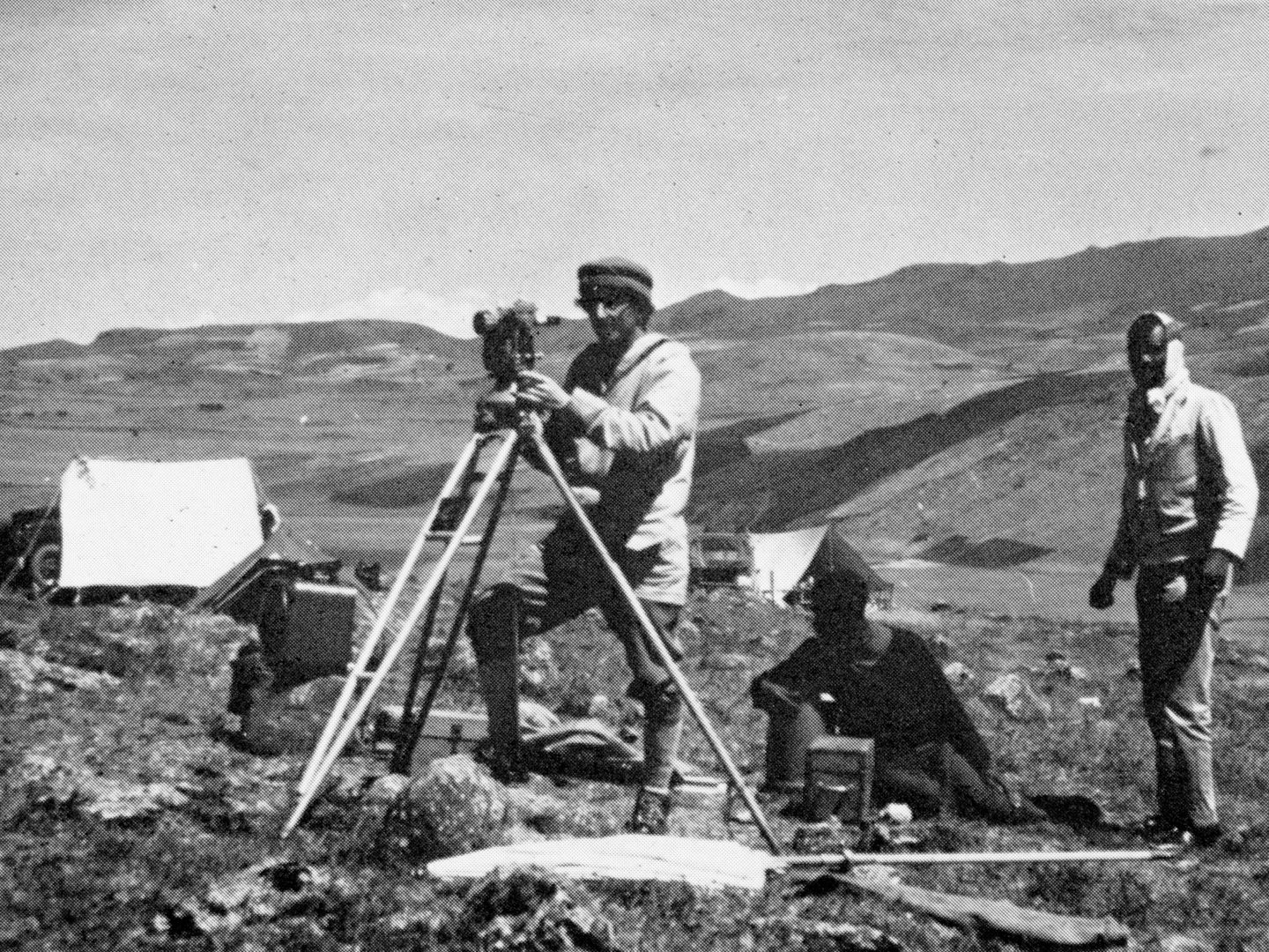
Directorate of Overseas Surveys staff undertaking observations at Tulu Kamale in Ethiopia.
The DOS contracted wide-ranging aerial surveys of each country to provide a basis for cartography. In turn, the cartography and aerial images helped to inform the development and administration of each country. When the Colonies moved to independence, the remit of the DOS was expanded to include countries within and outwith the Commonwealth, which meant the Directorate's surveyors ultimately surveyed fifty-five countries around the world.
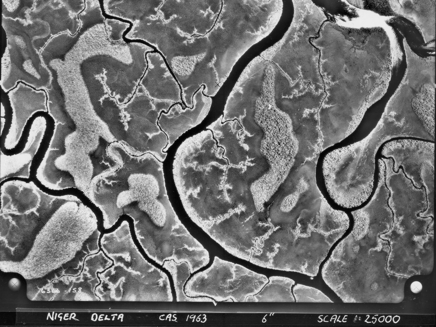
Niger Delta, Nigeria; Collection: DOS, Sortie: CAS/6366, Frame: 0158 (1963)
A Photographic Doomsday Book
Flown during peacetime, the photography provides a unique historical perspective and is in effect a modern-day 'Doomsday Book' of the Commonwealth. Global coverage included countries in Australasia and the Far East, the Indian Subcontinent, Middle East, Africa, Caribbean, South America, British Antarctic Territory and islands in the Pacific, Atlantic and Indian Oceans and the Mediterranean Sea.
Aerial photography of each country was taken by the Royal Air Force and contracted from a variety of commercial survey firms and exploited by staff at the DOS offices in Tolworth, UK. The aerial photography in the DOS Collection records the changing urban and rural landscape of large parts of the Commonwealth throughout the second half of the twentieth century. Additionally, as there is typically a 60% overlap between each frame captured, nearly all the images in the collection can be viewed in stereo, illustrating the 3D topography of the landscape below.

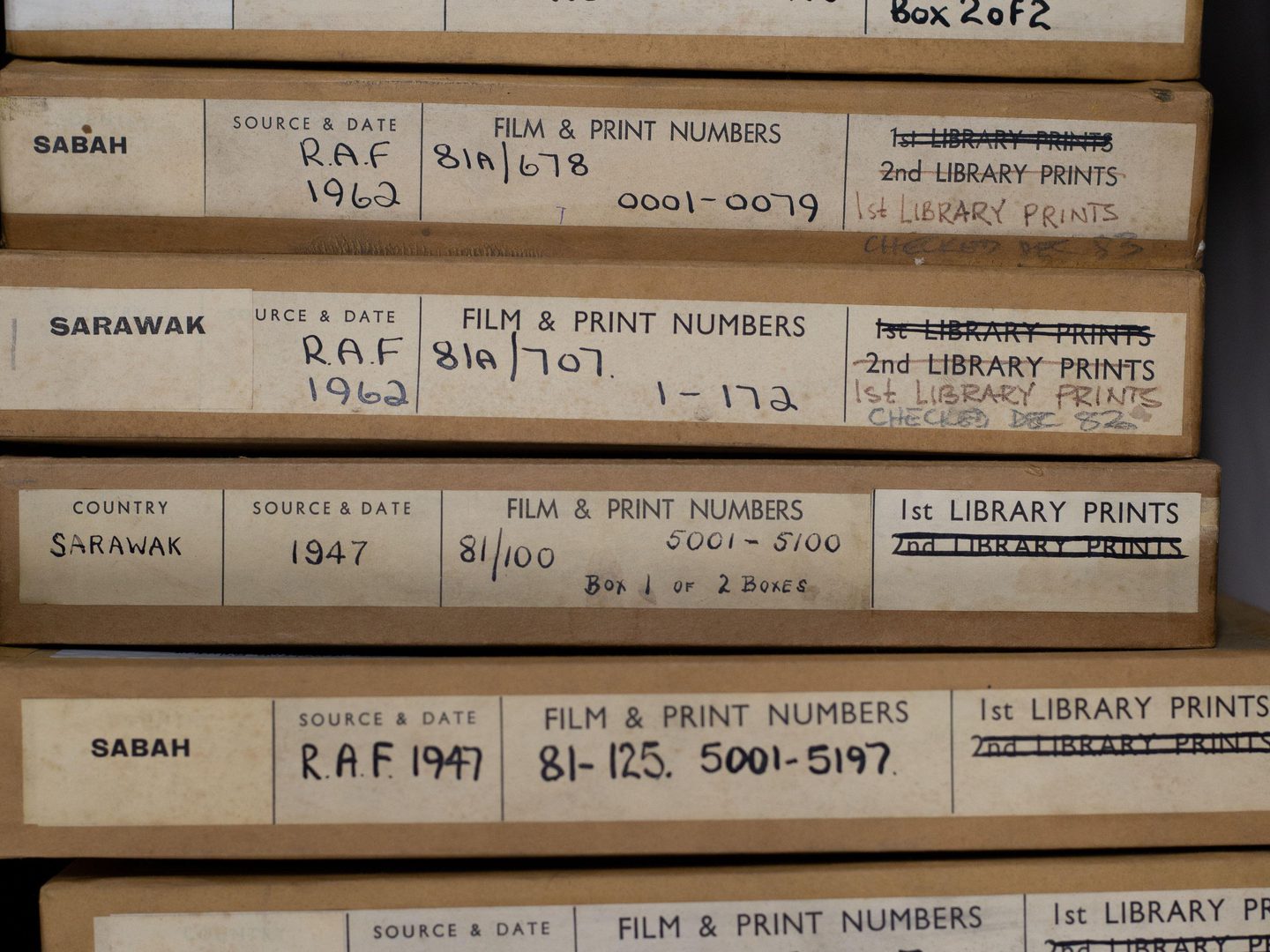
After its storage in less-than-ideal conditions before coming to NCAP, the DOS material needed careful treatment before digitisation.
Rescue and Regeneration
The National Collection of Aerial Photography (NCAP) became the official custodian of the 1.7 million aerial photographs created for the DOS in late 2012. It was saved from landfill by Allan Williams, Head of NCAP, who recognised its significance and value of this often unique imagery. In 2021 NCAP launched the DOS Project, a pioneering undertaking to digitise the whole collection through innovative use specially adapted collaborative robots.
The DOS Project saw three major international institutions working together; NCAP as part of Historic Environment Scotland (HES), Stockholm University and the University of California (Berkeley). The multi-year project was grant-funded by the Bank of Sweden Tercentenary Foundation. Its work will have wide-reaching implications for science and climate change research.
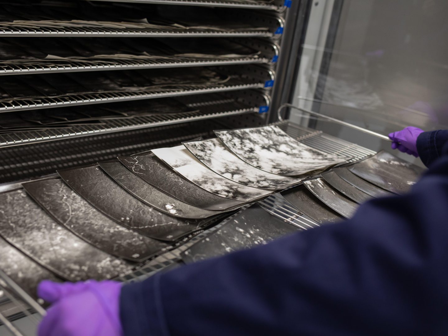
Many of the prints in the DOS Collection had to be gently humidified to relax and flatten them before they could be manipulated by the robots.
the dos project
Thanks to The DOS Project, NCAP has successfully preserved and scanned the entire photographic collection, recently delivering the final batch of data to the project’s international partners. These partners will now leverage the digital assets to inform future endeavors spanning social, economic, environmental, and computing domains.
The transformation brought about by The DOS Project lies in making historical photography readily accessible in digital format. This accessibility will revolutionise the availability of data documenting global environmental changes over the past century. The data holds the key to enhancing our comprehension of the origins and repercussions of long-term environmental shifts, encompassing biodiversity loss, deforestation, and climate change.
Ultimately, the georeferenced imagery generated by our international partners will be openly and freely accessible to all for non-commercial purposes.
Read more about the DOS Collection on our Image Collections pages.
Justyne Snyder, NCAP Sales Admin Assistant