Hong Kong Aerial Imagery Dating Back to 1924
100 years of history
The NCAP collection holds an impressive bank of visual material with more than 1,600 aerial photographs of Hong Kong's landscape dating back a hundred years to 1924, making these images the earliest photography in our collections. These images offer a fascinating glimpse into the city's past, capturing its essence before experiencing significant urban expansion throughout the mid 20th century.
Taken from seaplanes operating off HMS Pegasus and HMS Eagle, these aerial images were originally intended to aid in the topographic mapping of the region. Many of these photographs have been carefully annotated by military surveyors, detailing contours, drainage channels, and place names, providing invaluable insights into Hong Kong's geographical make up.
With the addition of images taken over the following decades, a comprehensive catalogue of Hong Kong imagery is accessible on our Air Photo Finder. With over 11,000 images available, users can explore images from the 1920s through the 1960s, exploring the evolution of this historical city.
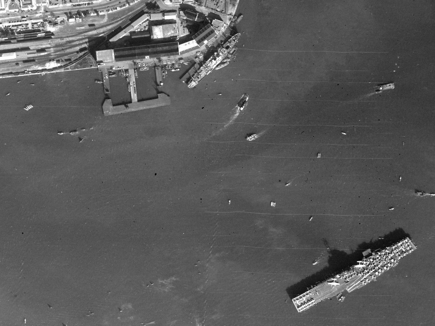
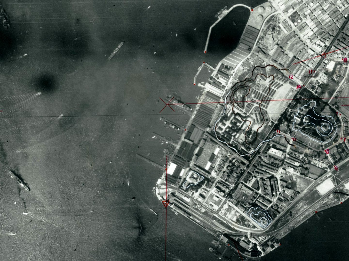
An aircraft carrier and other ships in Victoria Harbour, Hong Kong; Collection: JARIC, Sortie: 81A/RAF/0554, Frame: F22_0128 (27 December 1956)
Kowloon Walled city
A depiction of the bustling activity within Hong Kong harbour can be found within these records. From traditional fishing boats to aircraft carriers and flying boats, the diverse array of shipping vessels captured, offers a fascinating insight into the maritime heritage of the region.
The NCAP archive also provides a unique opportunity to observe the growth and transformation of the Kowloon Walled City during the 20th century. A densely populated area throughout most of it’s known history, the urban area experienced significant population growth as refugees fled various conflicts in China, including the Second World War. Kowloon Walled City eventually became one of the most densely populated areas in the world, peaking at 33,000 residents occupying less than 7 acres, before its demolition in the 1990s. Aerial images capture the evolution of Kowloon's urban landscape, tracking its expansion and architectural changes. These images provide a unique historical record documenting Kowloon during this transformative period.
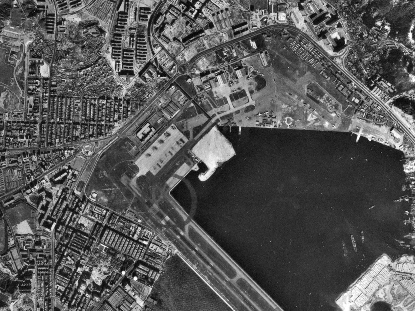
The Kowloon Walled City (top left) and the start of the Kai Tak airport runway; Collection: DOS, Sortie: HSL/HK/64/0003, Frame: 2606 (13 December 1964)
With high-resolution of our earliest imagery now available, users can explore these images with great detail and can view the changing landscapes of Hong Kong's rich past. Whether you are a historian, architectural enthusiast, urban planner, or simply curious about the city's evolution, NCAP’s extensive image library offers a captivating journey through time.
Read more about collections containing imagery of Hong Kong in our Image Collections pages.
Justyne Snyder, NCAP Sales Admin Assistant