NCAP Reveals the Geology of the World
As a medium, aerial photography is perfectly suited to understanding the world’s geology. From mapping geological features to illustrating geological processes, tracking huge changes in the Earth’s geography or just marvelling at amazing natural wonders, the National Collection of Aerial Photography (NCAP) can show off the best of the world’s geology.
Geological Formations
Aerial photography is a good way to view and understand often huge and complex areas of geology. When the Department of Overseas Surveys began flying over Jamaica, they were able to map extensive areas of karst, where highly soluble rocks erode to form caves, sinkholes and hollows. The area of limestone pavement around Malham Cove in Yorkshire is another example of a karst landscape.
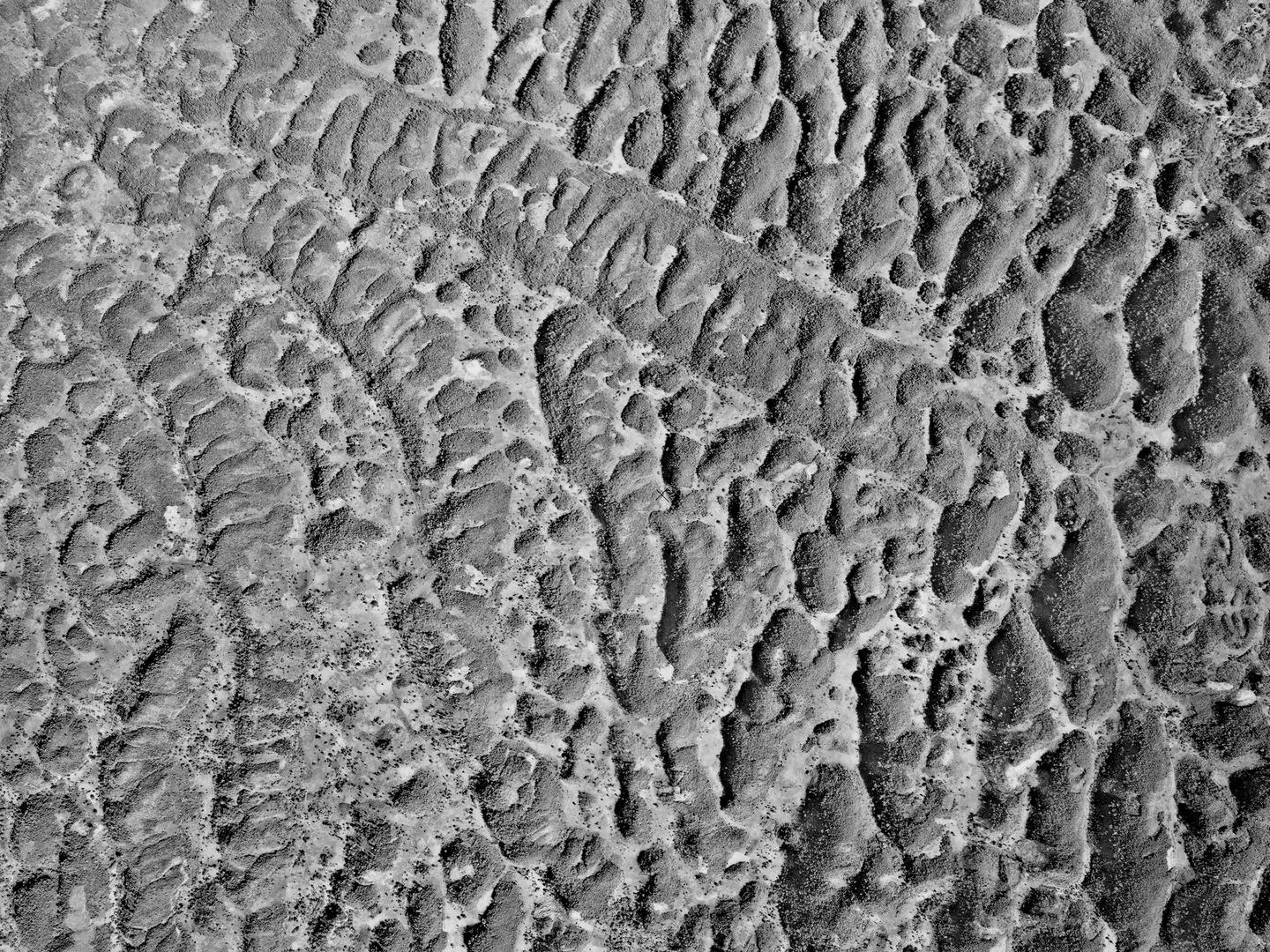
The so-called cockpit karst landscape of central Jamaica; Collection: DOS, Sortie: 55/JA/0006, Frame: 0100 (15 March 1961)
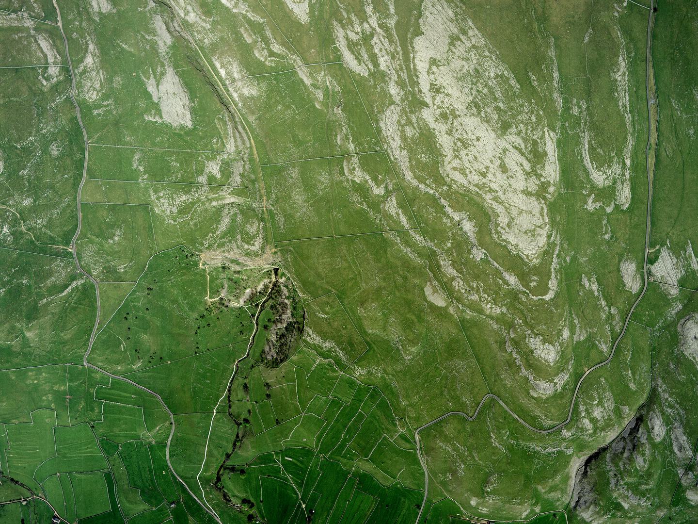
Malham’s limestone pavements, with Malham Cove just left of centre; Collection: Simmons Aerofilms, Sortie: AF/92C/0574, Frame: 8979 (17 May 1992)
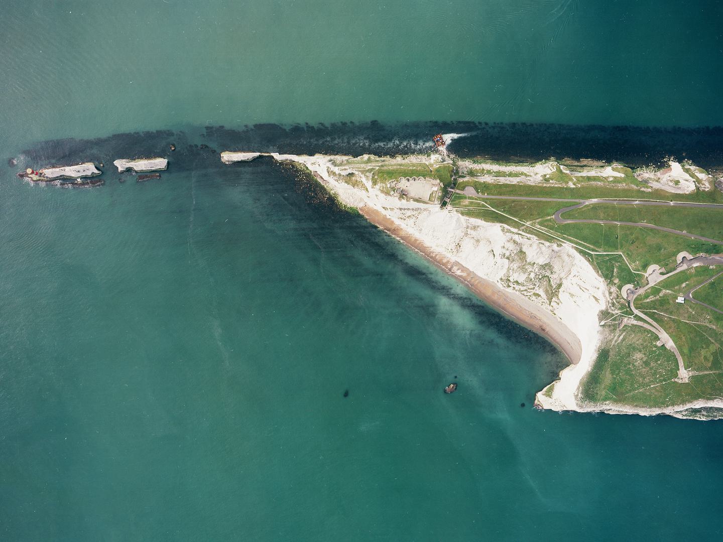
Further south in England is the Jurassic Coast, an extensive area of prehistoric cliffs exposed by coastal erosion and famous for their fossils. The variable hardness of the different rocks in the area has formed numerous geological landforms which are clearly visible from the air, such as Lulworth Cove. The same band of chalk that forms Lulworth Cove stretches all the way to the Isle of Wight, where it has created the geological formation known as The Needles.
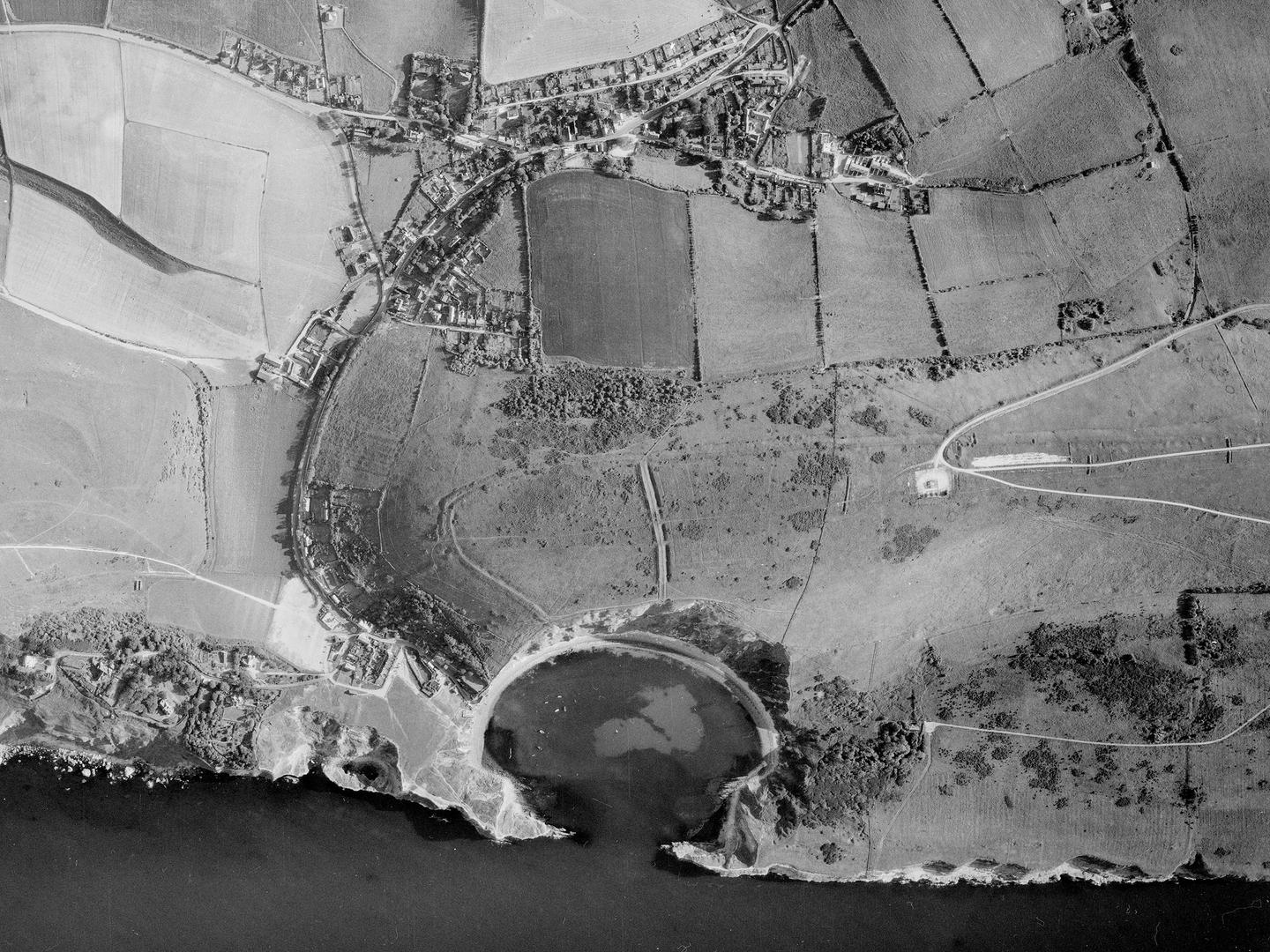
The distinctive horseshoe shape of Lulworth Cove; Collection: AIRBUS, Sortie: JAS/0025/72, Frame: 0009 (1972)

The chalk cliffs of The Needles protruding from the west end of the Isle of Wight; Collection: BKS, Sortie: BKS/UK/00/0034, Frame: 0614 (17 May 1992)
The East African Rift – part of the Great Rift Valley series of connected geological faults – stretches 4,000 miles from the Gulf of Aden in the north along the eastern coast of the African continent to the south coast of Mozambique. It marks the area where the African tectonic plate is slowly splitting in two. Such an enormous geological feature is only really visible from the air.
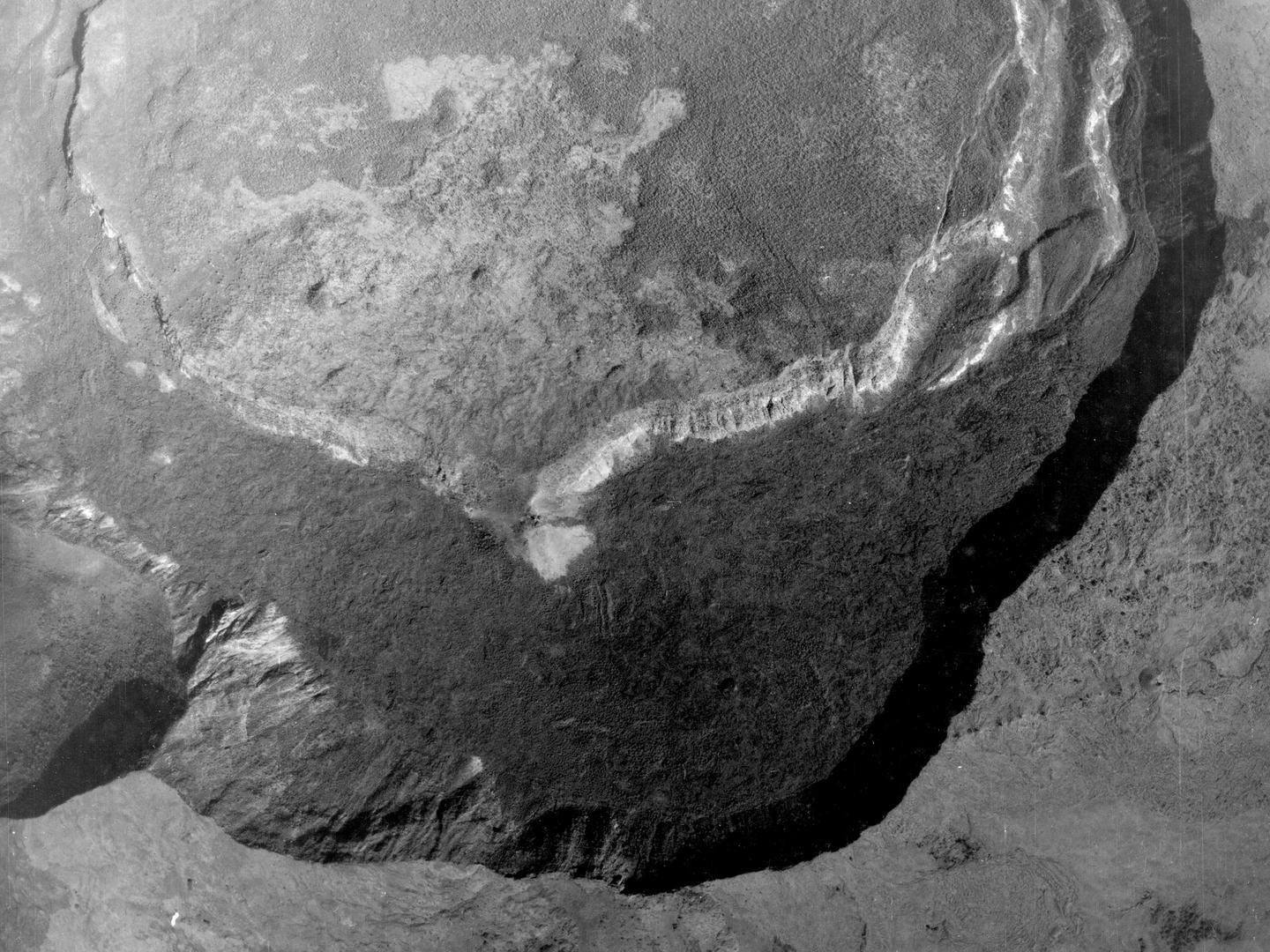
The double crater of the Mount Suswa shield volcano, Kenya, part of the East African Rift; Collection: DOS, Sortie: CPE/KEN/0126, Frame: 5002 (15 February 1948)
Our Changing Planet
Aerial photography can also remind us of how vulnerable we are to the whims of the planet we live on. While the constant changes in the Earth’s geology are imperceptible to most of us, NCAP’s images can illustrate some of the dramatic ways the rock beneath our feet can affect our lives.
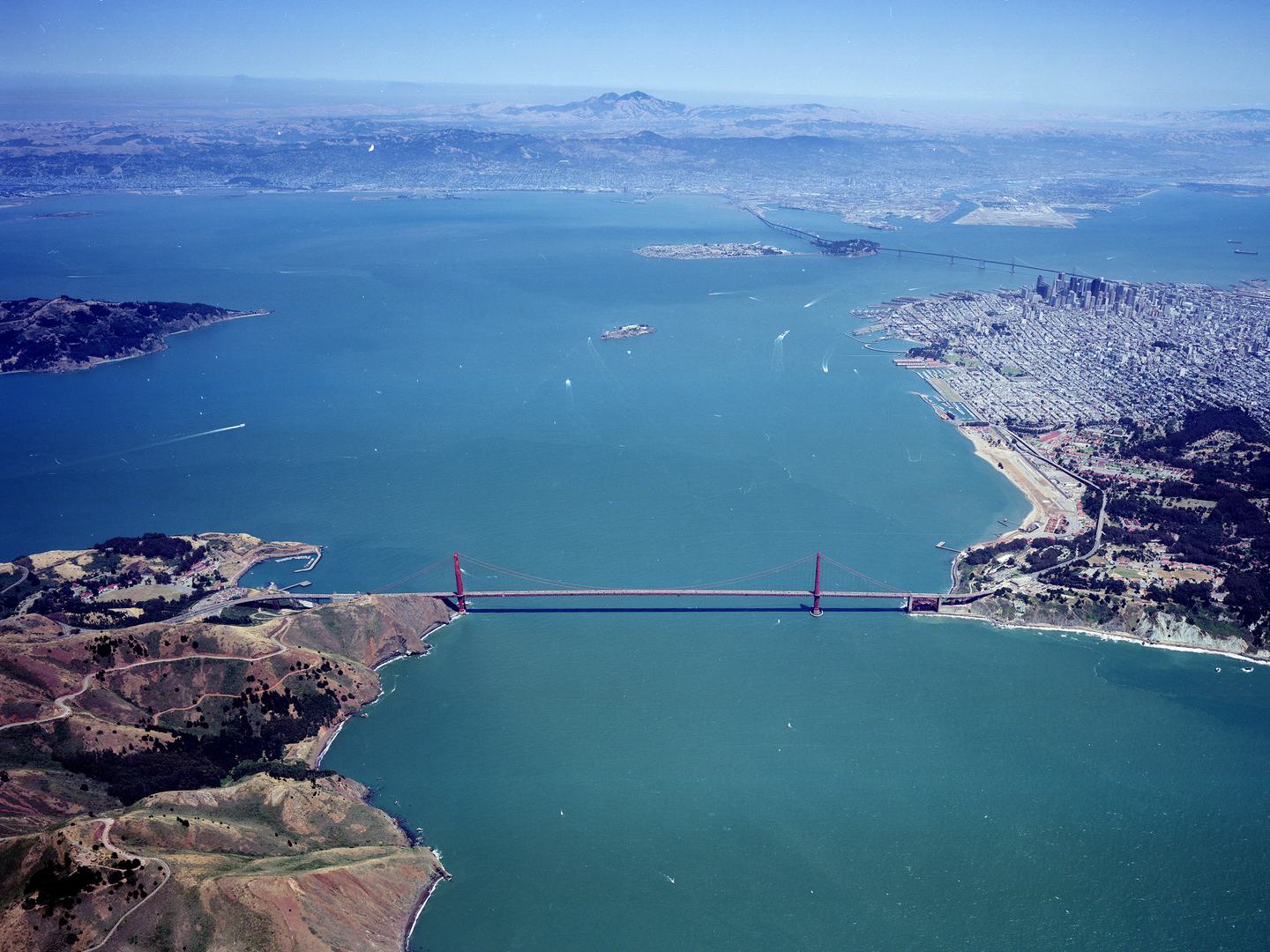
The world-famous Golden Gate Bridge, spanning the Golden Gate Strait; Collection: AIRBUS, Sortie: GEONEX/0072/93, Frame: 0034 (28 June 1993)
The San Andreas Fault is one of the most famous areas of geological activity in the world. Running throughout California, it marks where two tectonic plates slide past each other, causing regular earthquakes and other geological activity. About 560,000 years ago, movement in these same plates started the formation of what is now the San Francisco Bay area, leading eventually to the construction of one of the most iconic structures in the world – The Golden Gate Bridge.
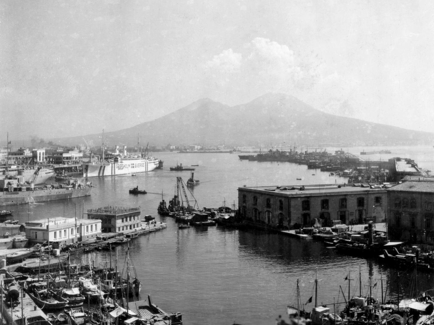
Mount Vesuvius across the Bay of Naples; Collection: POTTS, Frame: 0010 (1930)
Perhaps the most famous volcanic eruption in European human history is that of Mount Vesuvius in 79 CE, which destroyed several Roman towns – including Pompeii and Herculaneum – and killed thousands people. Vesuvius has remained highly active into the twentieth century, with the last major eruption occurring in 1944. That is the same year Leading Aircraftman Robert Potts - in Italy with the Mediterranean Allied Photo Reconnaissance Wing - took this ground photograph of the volcano.
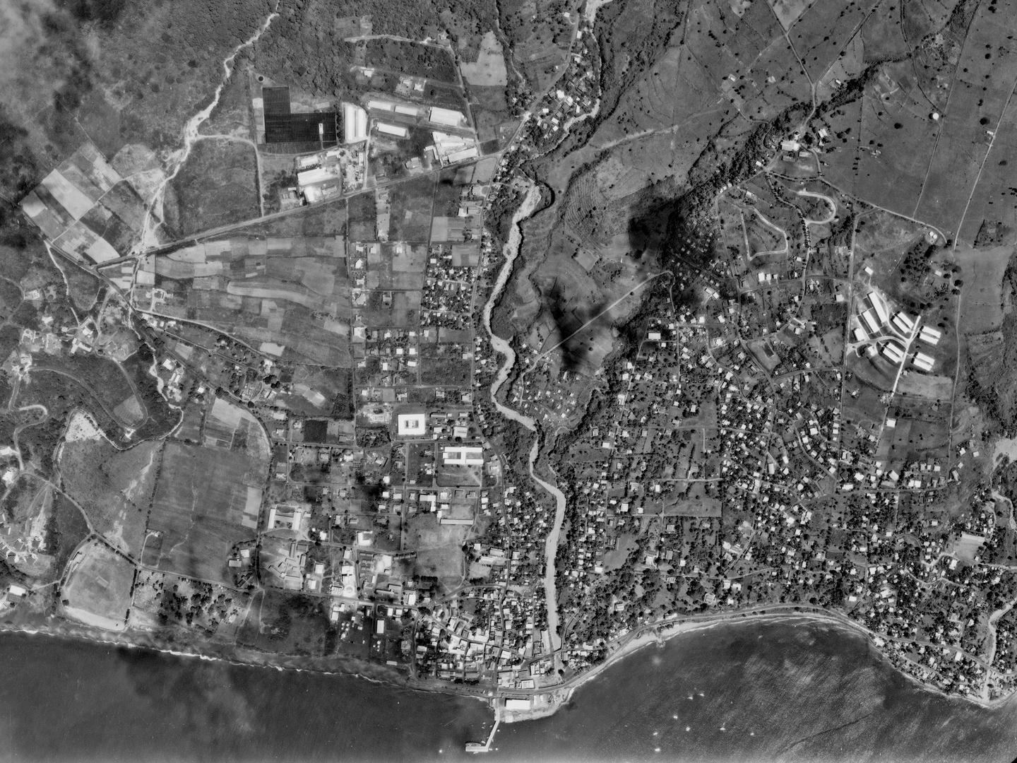
Plymouth, the capital of Montserrat, before its destruction; Collection: DOS, Sortie: 195/MO/0001, Frame: 0143 (22 February 1982)
More recently, the Caribbean territory of Montserrat was devastated by a series of volcanic eruptions through the 1990s, which drove thousands of people to flee the island. NCAP imagery clearly shows the changes wrought. The island’s capital, Plymouth, was a thriving town in 1982; by 1999, it was swamped in ash and mud and had been abandoned. People remain excluded from Plymouth, and the whole southern half of Montserrat, although they have started to return to the island as a whole.
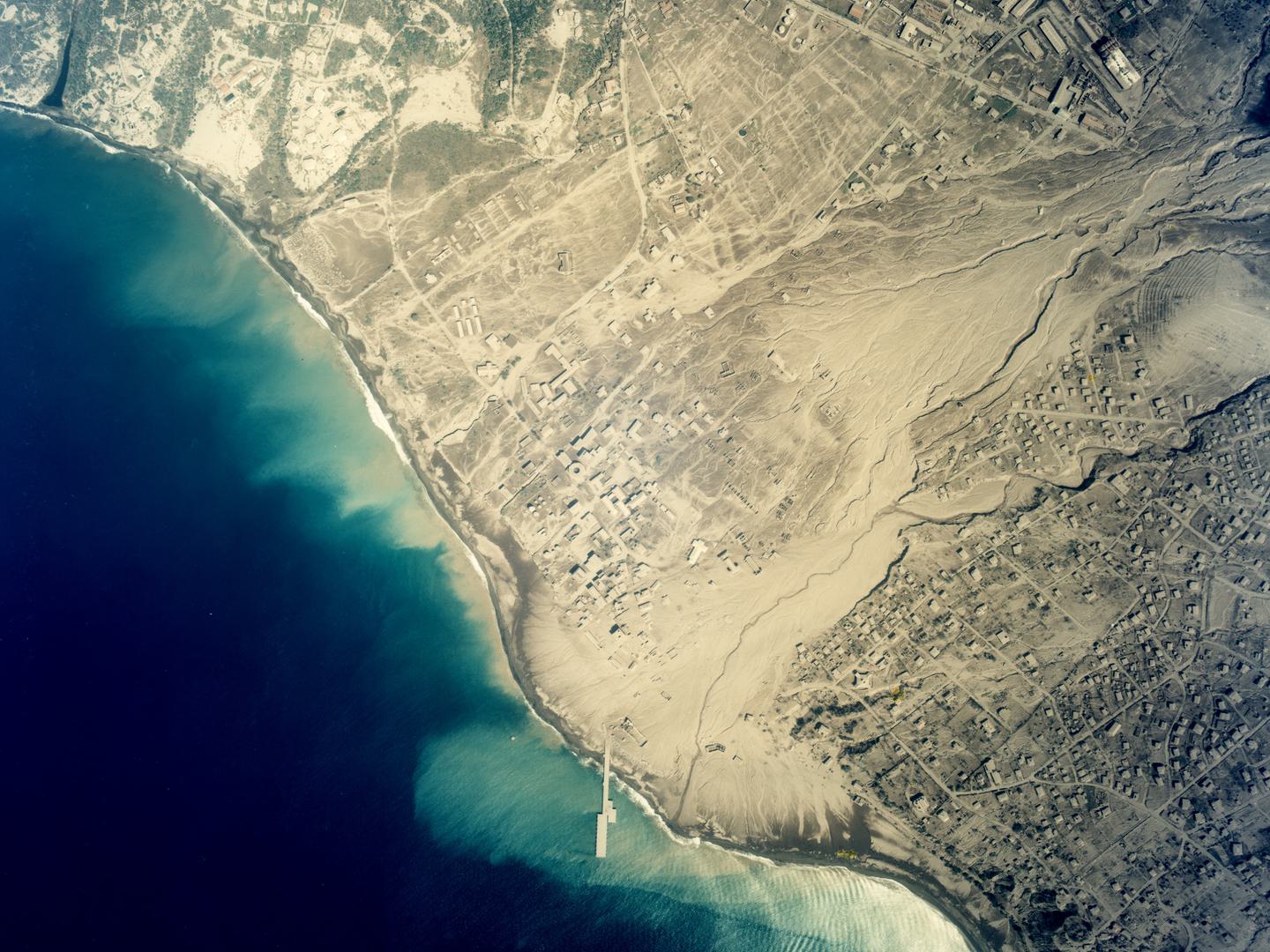
Plymouth after years of volcanic activity forced its abandonment; Collection: DOS, Sortie: BGS/51226, Frame: 2497 (2 August 1999)
Natural Wonders
As well as devastation, the geological processes that shape our planet can also produce stunning areas of geological beauty. The Brazilian city of Rio de Janeiro is built on coastal plains surrounded by dramatic gneiss-granite hills and mountains. The distinctive domes and monoliths, rising almost straight out of the sea, create one of the most distinctive cityscapes in the world. The photos below were taken in 1930, just a year before the famous statue of Christ the Redeemer was completed.
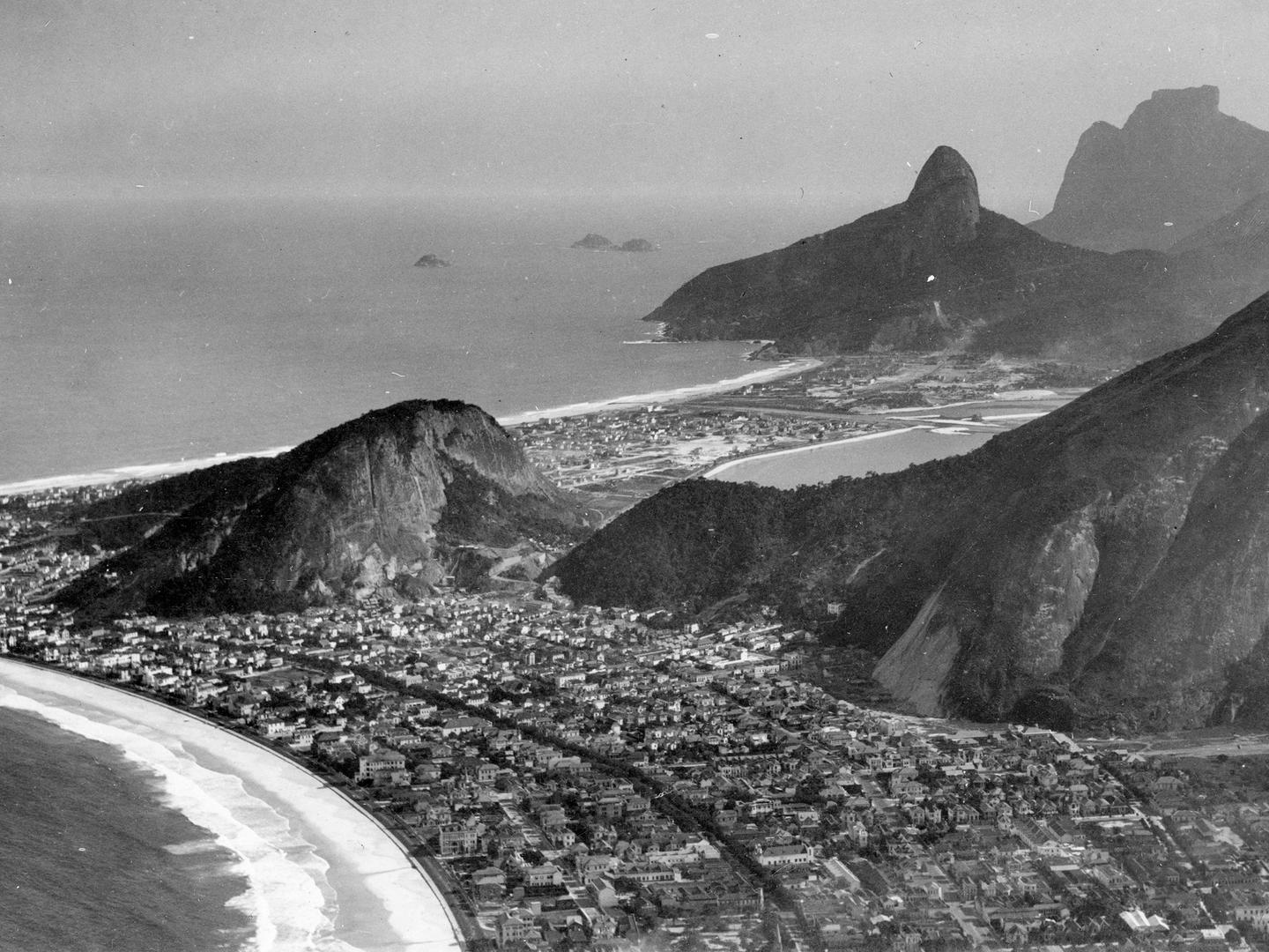
The city of Rio de Janeiro sprawls between numerous rocky peaks; Collection: ACIU, Sortie: WAVELL/RIO, Frame: 0011 (1930)
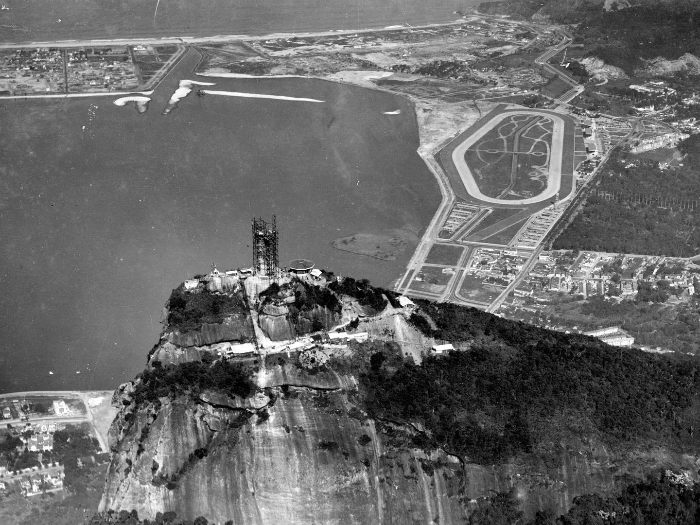
Christ the Redeemer stands swathed in scaffolding on Corcovado, one of Rio’s most prominent granite domes; Collection: ACIU, Sortie: WAVELL/RIO, Frame: 0017 (1930)
Iceland is one of the most unique parts of the world thanks to its incredibly active geology. The island straddles the mid-Atlantic ridge, where the North American and Eurasian tectonic plates pull away from each other. This creates a landscape marked by the impacts of volcanoes and earthquakes, and riddled with geysers and geothermal lakes.
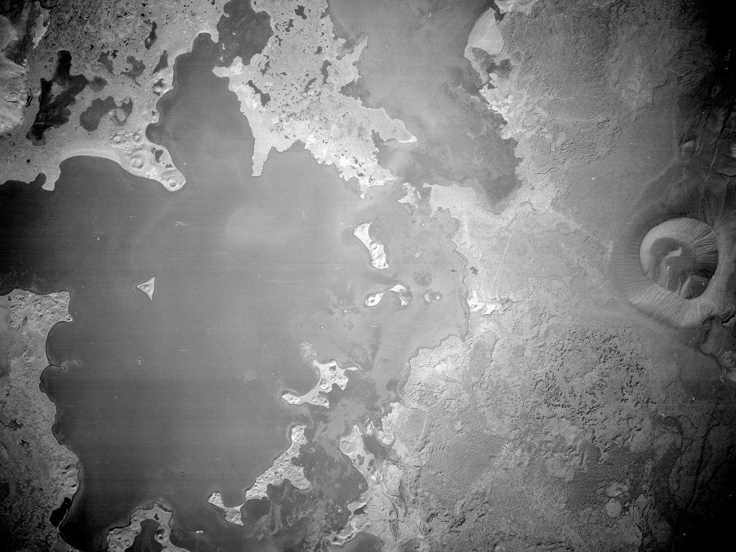
The volcanically formed Mývatn lake next to Hverfjall volcano; Collection: NARA, Sortie: 364BS/1218/02, Frame: 0110 (30 August 1945)
Millions of people visit the islands of Hawaii every year, to absorb its culture, visit its beaches and enjoy its tropical climate. The islands were formed as the Pacific tectonic plate travelled over a volcanic hotspot – a superhot area in the mantle beneath.
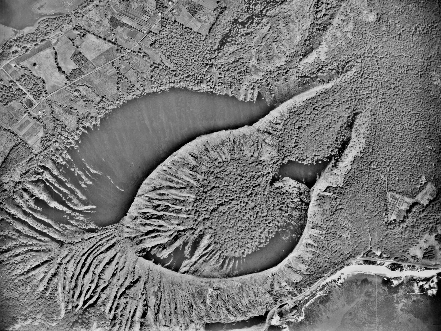
The Koko Crater on the island of O’ahu, part of the Honolulu Volcanics range; Collection: NARA, Sortie: M/0046, Frame: 0093 (10 January 1940)
Evidence of this volcanic activity is clearly visible in the geography of the Hawaiian islands. The constant conflict between volcanic activity and the sea forms a central part of Hawaiian myths and religion.
Ben Reiss, NCAP Collections Manager
Find out more about the collections featured in this article.
British Survey Firms Directorate of Overseas Surveys NARA Allied Central Interpretation Unit
