Reinterpreting the Directorate of Overseas Surveys Collection

The new exhibition ‘Reinterpreting the Directorate of Overseas Surveys’ illustrates the great potential of the DOS Collection (cared for by the National Collection of Aerial Photography) for interdisciplinary research and study.
The Directorate of Overseas Surveys
Established at the end of the Second World War, what later became the Directorate of Overseas Surveys (DOS) utilised wartime advances in aerial photographic technology to create mapping of Commonwealth countries (the vast majority of which are now former territories of the British Empire).
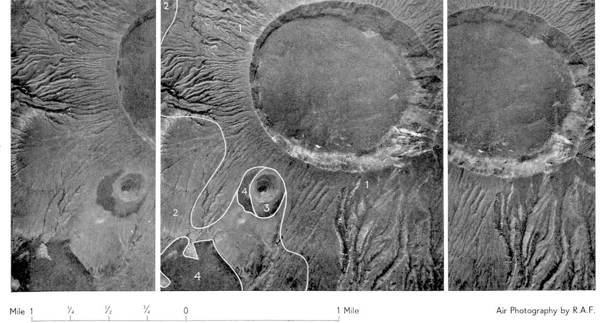
The extinct Mount Longonot volcano northwest of Nairobi, where development of renewable energy sources can present environmental risk. Collection: DOS, Sortie: 82D/RAF/0162, Frame: 5058 (3 March 1950)
Throughout the second half of the 20th century, the DOS created aerial coverage of many previously undocumented regions of the world. Today, the DOS collection of more than 1.7 million photographs is preserved as part of the National Collection of Aerial Photography (NCAP). Though originally intended primarily for the creation of mapping, the DOS collection has shown great potential for interdisciplinary research and study.
The DOS Project Partnership
Through a partnership with Stockholm University, Sweden and the University of California (Berkeley), NCAP has preserved and digitised the DOS collection, safeguarding these unique historical records, and making them accessible for researchers around the world.
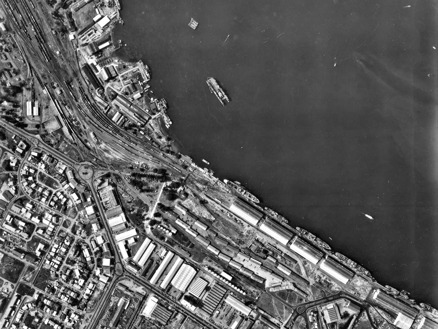
The Lagos Port Complex in Apapa is Nigeria’s largest and oldest port complex, accommodating significant import and export traffic. Collection: DOS, Sortie: LAGOS/FILM/9, Frame: 0048 (23 March 1961)
Reinterpreting The Directorate of Overseas Surveys
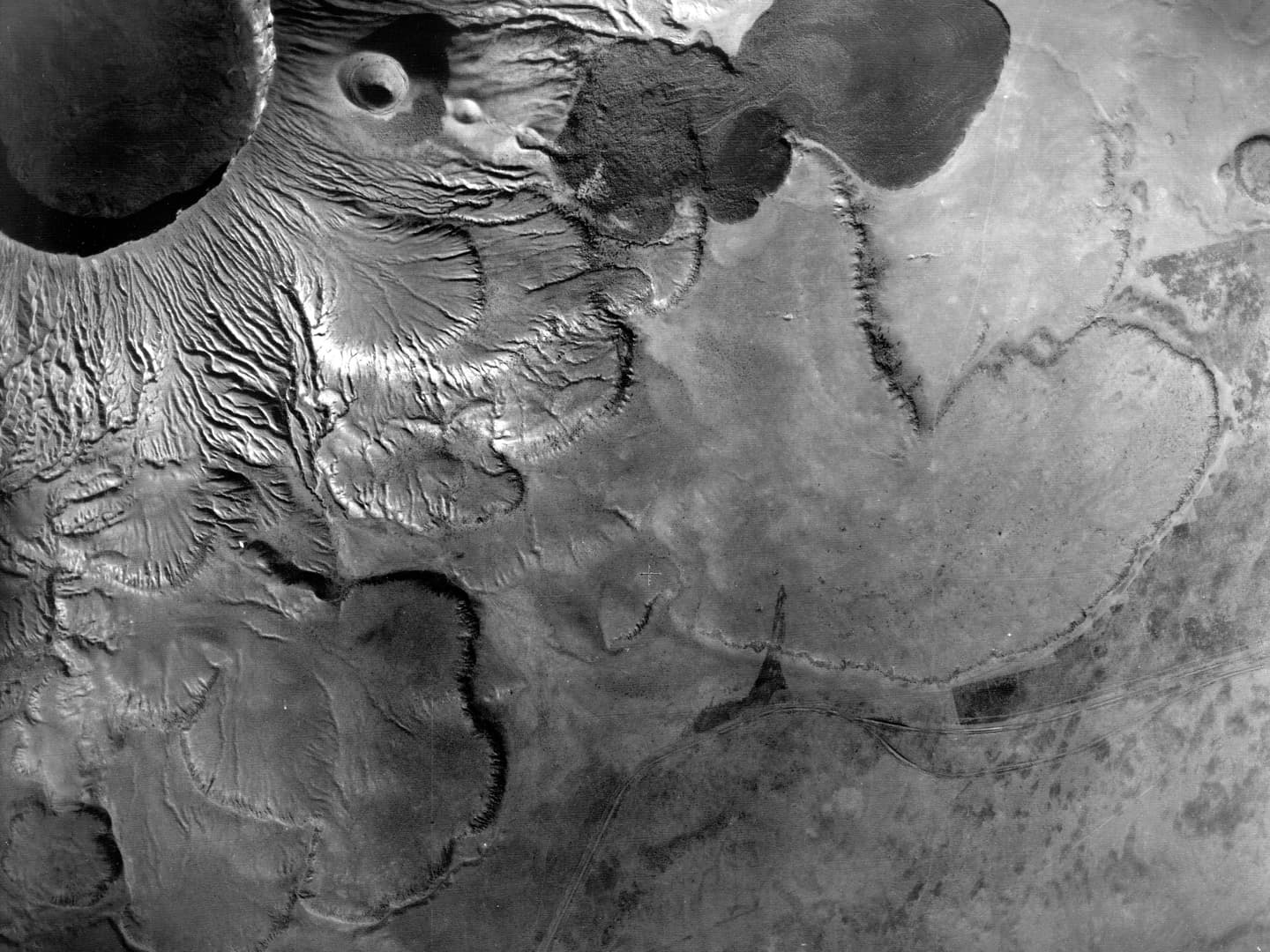
The small selection of images on display in ‘Reinterpreting the Directorate of Overseas Surveys’ were taken between 1946 and 1991, and showcase three examples of the research value of this material. Images of Kenya document the impact of environmental and climate change on the region. Through this documentation it is possible to identify environmental change, even when untouched by development or resource extraction.
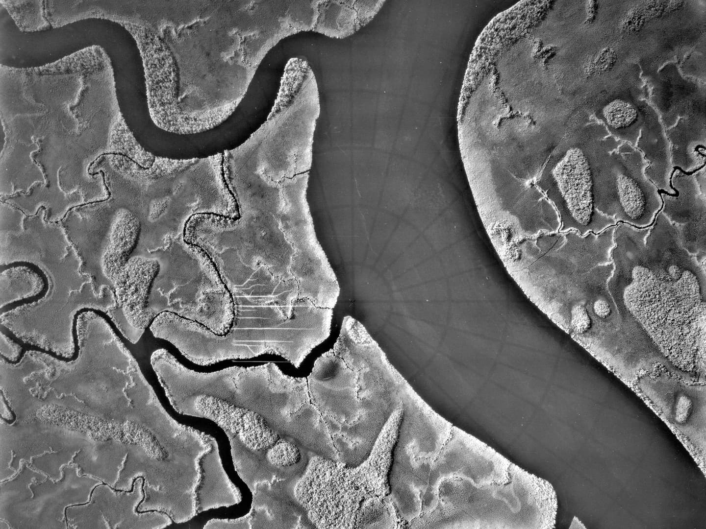
Oil is central to the Nigerian economy, but this wealth has come at an environmental cost to the Niger Delta. Collection: DOS, Sortie: SHELL/BP/0044, Frame: 0025 (March 1963)
Images of Lagos, Nigeria track the extent of urban development and the growth of industry. Through DOS imagery it becomes possible to see Lagos’ development as a port city in the 20th century. Images of the Niger Delta region reveal the expansion of the oil and gas industry, and the environmental consequences for local communities of these exploitative practices.
You can visit ‘Reinterpreting the Directorate of Overseas Surveys’ at the University of St Andrews Arts Lecture Theatre Foyer, from Wednesday 26 March 2025 until the end of July 2025.
Vivian Myron, NCAP Metadata Coordinator
DOS Collection Completion of the DOS Project DOS Project Perspective