The Story of the Directorate of Overseas Surveys
The Directorate of Overseas Surveys (DOS) project has been our largest print preservation and digitisation project to date. It spurred the innovative use of Cobots (collaborative robots, which operate alongside humans) to automate our scanning process and necessitated managing a volume of preservation work our team had never previously undertaken.
But how did the DOS Collection come to exist in the first place?
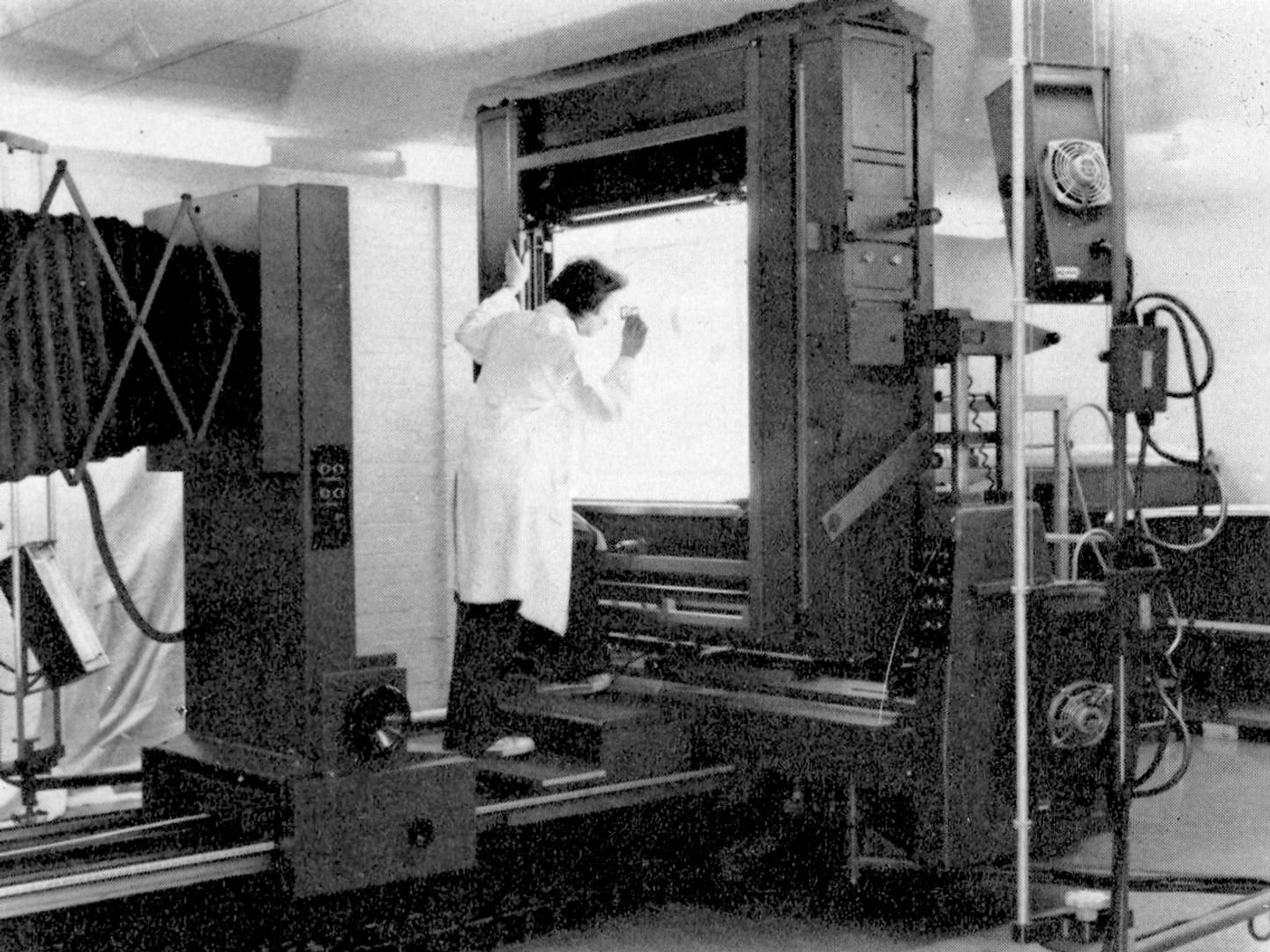
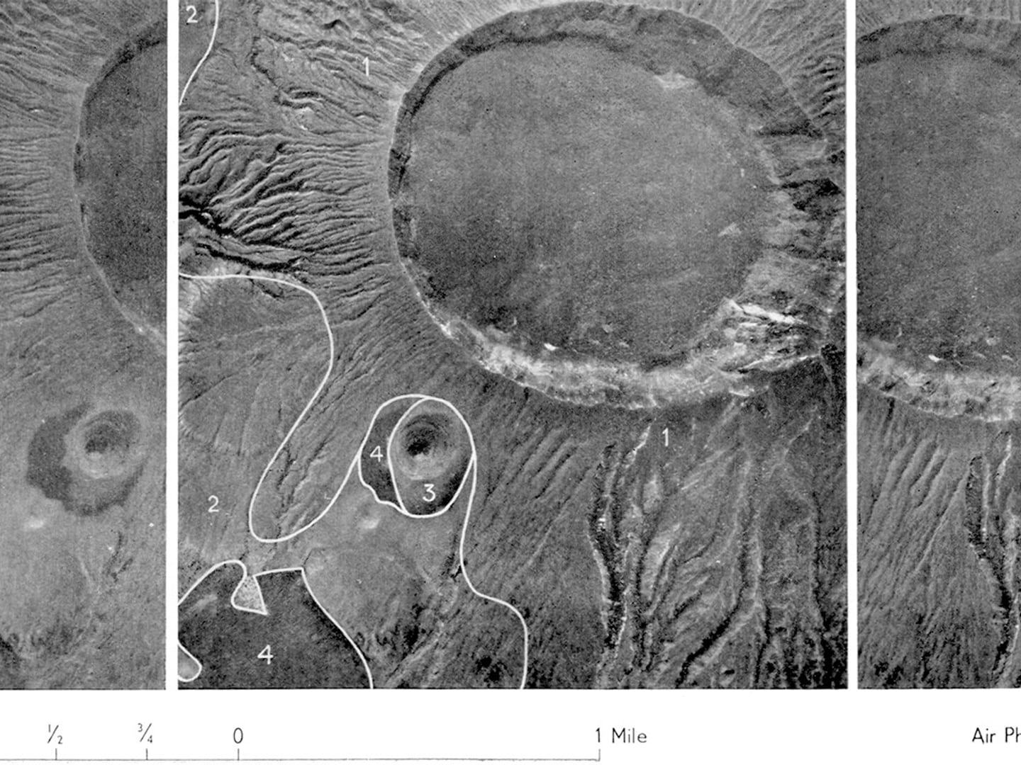
Examining work set up in the 40” x 40” process camera which was installed in the Photographic Section of the DOS to handle the largest size of material normally processed. DOS Annual Report, 1978.
early mapping
Over the course of the eighteenth and nineteenth centuries, Britain did a thorough job of accurately mapping the British Isles. However, many Commonwealth countries did not have the same degree of coverage and remained largely unmapped.
British anxieties about a lack of geographic knowledge, and by extension economic and military control, were exacerbated by the Second Boer War (1899-1902) at the turn of the twentieth century. A lack of accurate and complete maps in this conflict made it much harder for the British to fight effectively and gave those fighting on home territory a greater advantage.
This helped prompt a conversation about how the British Government might effectively map Commonwealth countries in Africa and other parts of the world. The resulting plans made by Colonel P K Boulnois, head of the Geographical Section of the War Office prior to 1941, and Brigadier M N MacLeod, a member of the Geographical Section, were put aside with the onslaught of the First and Second World Wars. However, in the Second World War both the Allied and Axis powers invested heavily in a surveillance tactic that would later prove vital to mapping the Commonwealth: aerial photography.
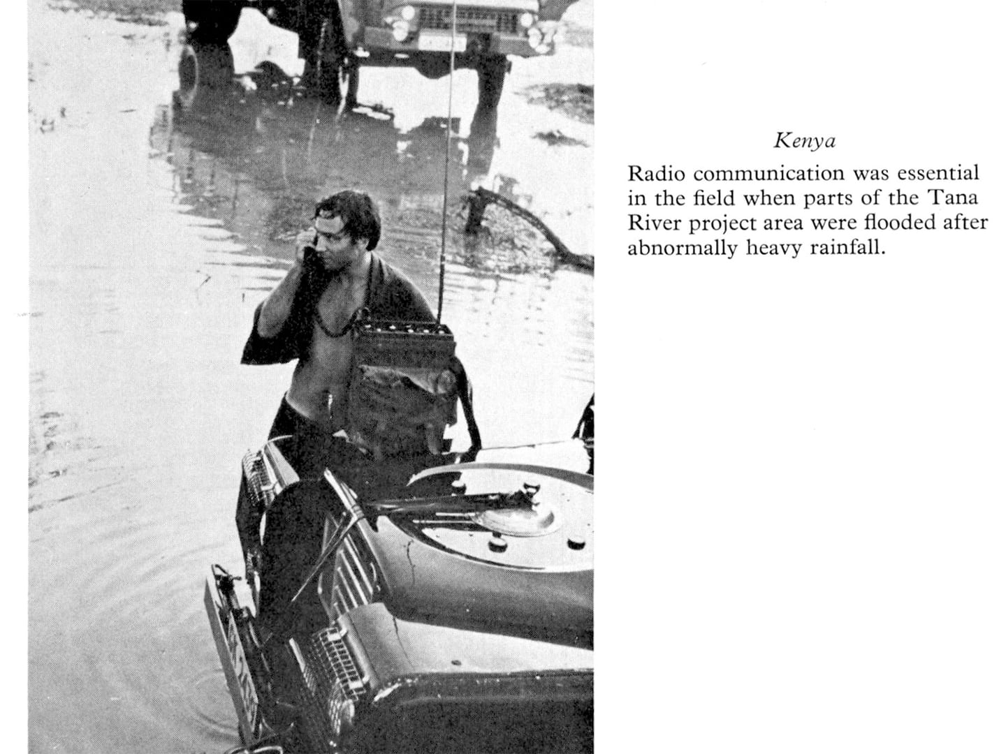
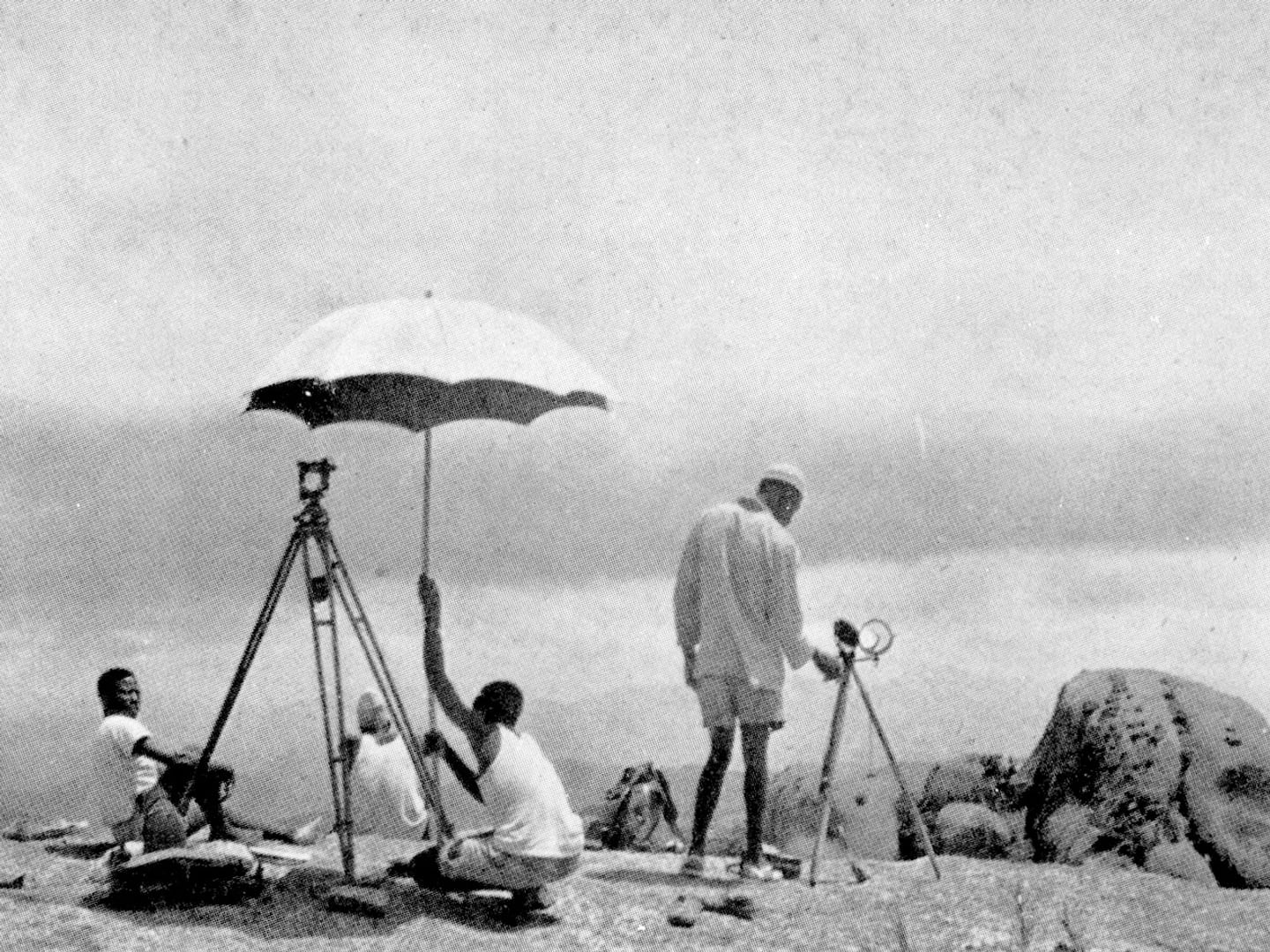
Ground survey teams worked in tandem with their aerial counterparts, navigating new and often unpredictable terrain. DOS Annual Report, 1978.
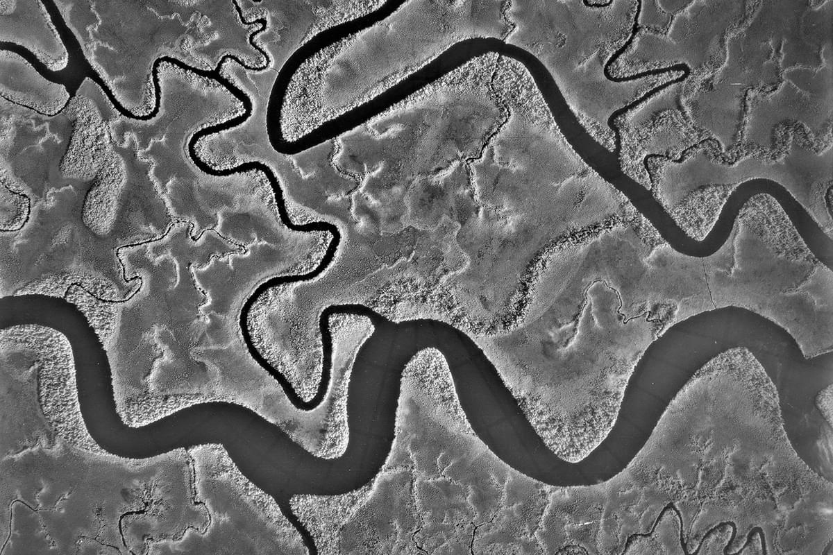
the importance of aerial photography
When the war ended there was a large number of surplus military aircraft, the technical hardware and the specialist personnel required to undertake photographic reconnaissance on a monumental scale. Brigadier Martin Hotine, first Director General of DOS, conceived the idea of taking advantage of all this expertise in aerial photography to travel to Commonwealth countries and carry out extensive photographic surveys that could then be translated into cartographical maps back in Britain. The aerial surveys team ran in concert with ground survey workers who built stations for navigation and operated on-the-ground survey camps.
the directorate of overseas surveys
Thus, in 1946 The Directorate of Colonial Surveys (renamed the Directorate of Overseas Surveys in 1957) was born. Over the next half a century, the DOS would produce millions of detailed photographs and maps of Commonwealth countries, documenting and influencing how borders changed, cities grew, and landscapes shifted in the twentieth century.
A survey station in the Fali Hills of Northern Nigeria. Access to the station was by foot only, and it was a three-day trek from the nearest road. DOS Annual Report, 1978.
In 1984, the DOS was merged with the Ordnance Survey. The program was shuttered in the 1990s as new technologies and approaches to mapping emerged.
None of this archive would be accessible today if it had not been preserved and digitised by the National Collection of Aerial Photography. In the second instalment of this series, we will look at how the DOS Collection came to be in our care and how we teamed up with researchers at Stockholm University to make the DOS Collection digitally accessible.
You can visit ‘Reinterpreting the Directorate of Overseas Surveys’ at the University of St Andrews Arts Lecture Theatre Foyer until the end of July 2025. There will be a reception and talks by NCAP Metadata Coordinator Vivian Myron and NCAP Operations Manager Rachel Nordstrom at the Arts Lecture Theatre, 17:30-19:30 on 30 April 2025.
Vivian Myron, NCAP Metadata Coordinator