
NCAP records as much data as possible about when and where images were taken
Vital reference information from print boxes is catalogued in the NCAP database
NCAP records as much data as possible about when and where images were taken
Cataloguing and Access
Digitising physical prints and rolls of film is just one stage in making the images held by the National Collection of Aerial Photography (NCAP) accessible. NCAP records detailed information about collections, their related sorties and each image frame captured.
access goals
By providing access to these essential resources, NCAP assists users in locating the images they require. Various pathways into the collection exist based on individual research needs. However, before these resources can be made publicly available, the team must fully catalogue all information to enhance records access and facilitate future retrieval.
Cataloguing and ‘Footprinting’
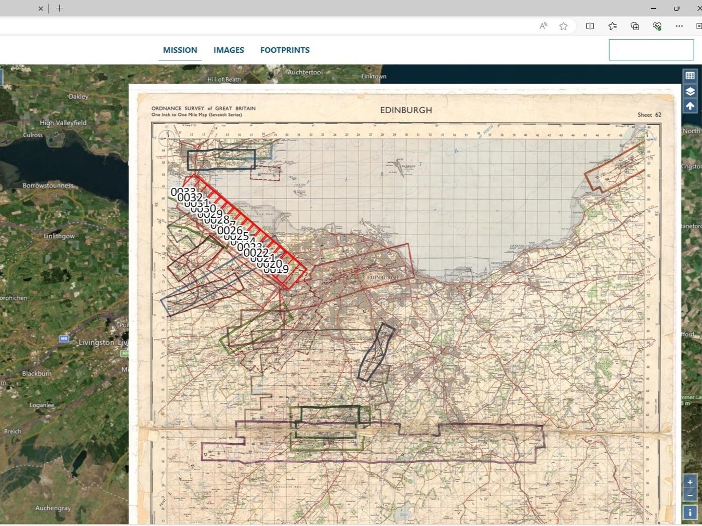
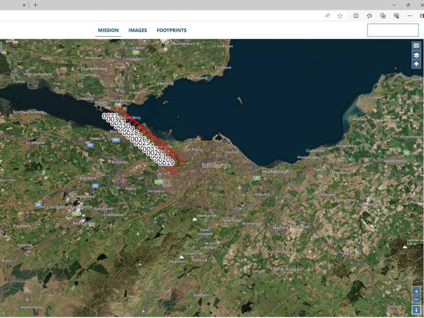
After images undergo digitisation for NCAP’s Air Photo Finder, the cataloguers create a geographic footprint for individual frames, enabling users to locate the images on the map-based platform. Our team compare the original sortie plots – which show aircraft flight paths during reconnaissance or survey missions – alongside a digital map of the same area. A digital outline of the area covered by the photograph is captured within the digital map, which is then stored as the image ‘footprint’ in the collection database.
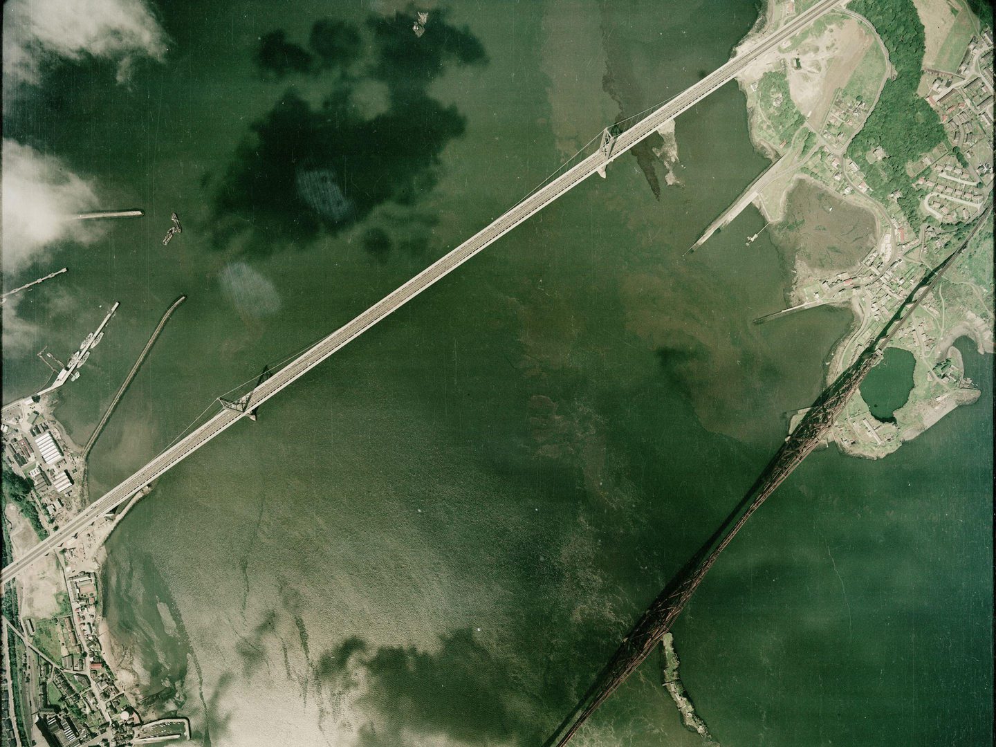
While most of NCAP’s images are vertical aerial photographs taken looking straight down, the collection also includes many oblique aerial photographs captured at an angle towards the horizon. This information is recorded alongside each digital image, ensuring the footprints reflect the relevant vertical or oblique perspective. For the best viewing experience, each vertical image is rotated with the northern edge aligned to the top of the frame, as this reflects the traditional way maps are positioned.
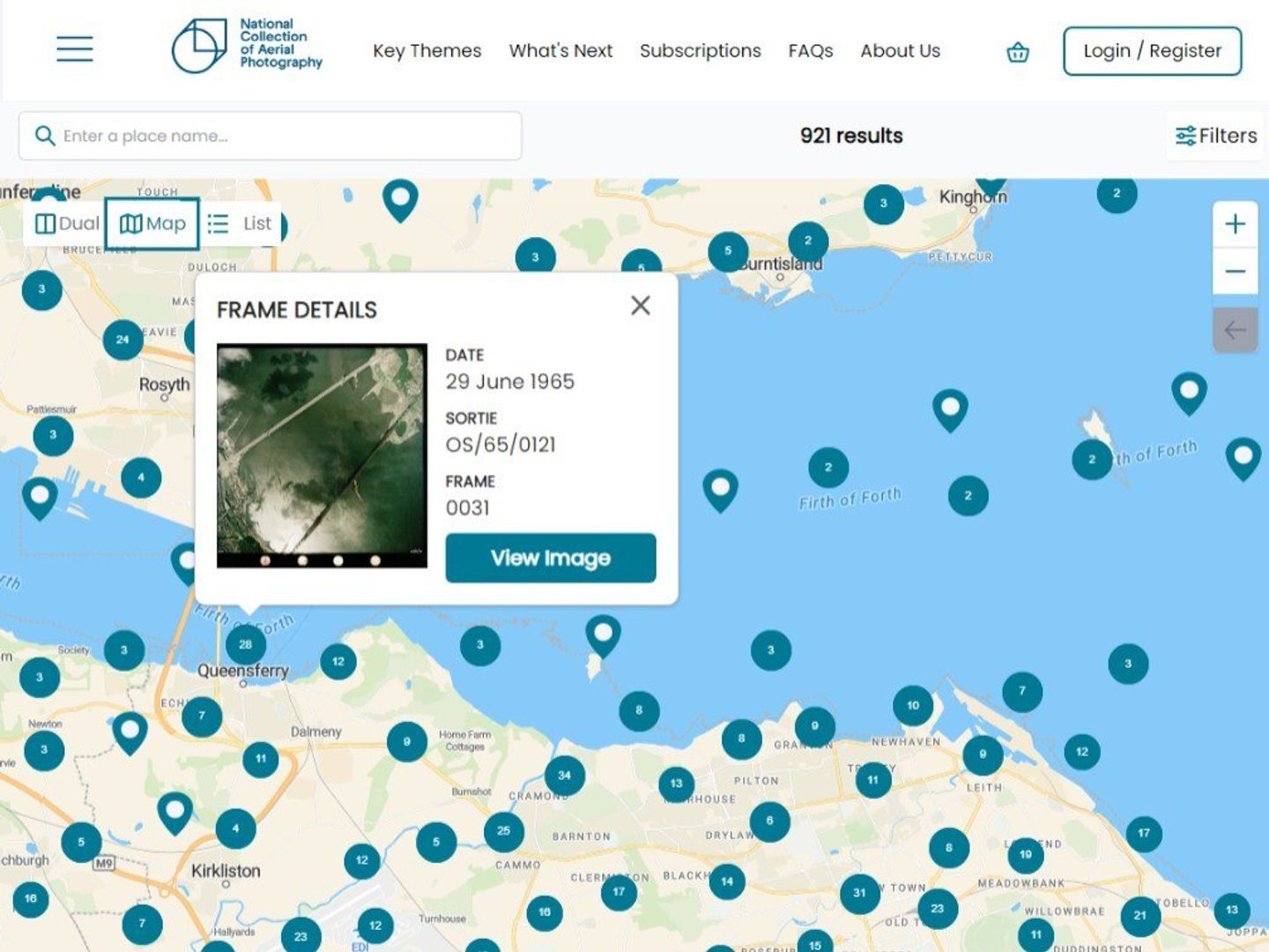
Additionally, we catalogue other details about the photographs in the NCAP Collection. This includes reference numbers for each sortie and frame numbers of each image, allowing users to identify specific photographs correctly and consistently. Our team also records the exact capture date for photographs, when it is available, allowing users to observe changes in landscape, buildings or the natural environment over time. Information about individual squadrons and pilots, where known, and a collections' history before it came to us, is likewise associated with each sortie and held in the ArchviesSpace information management application.
Access
Depending on your research questions, there are different pathways into the NCAP collections. These can range from wanting to view historic photographs of your family's ancestral home, to viewing land-use change over decades in regions around the globe. Or your questions may relate to certain collections as a whole, from records around particular military reconnaissance operations, to gaining a better understating of the political rationale which led to the photographic documentation of territories around the globe.
We aim to facilitate access to the collections to support research and public interest, no matter what your question might be.
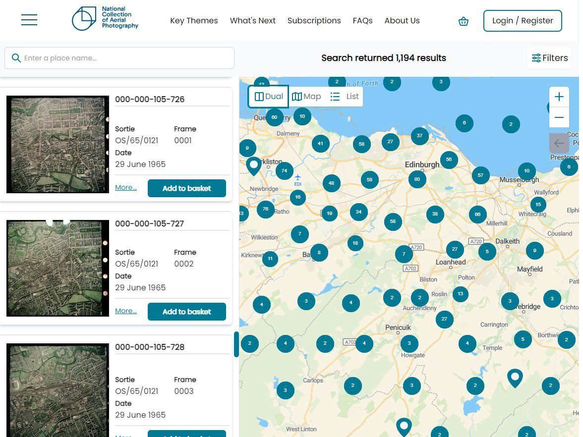
Air Photo Finder
Once images have been digitised, catalogued and processed, they will become accessible, and can be viewed on Air Photo Finder. By allowing you to navigate our map-based platform, filtering by photography date, our goal is to give you the tools to view as much imagery as we can provide from the ease of your home or office.
Purchasing high-resolution copies is now easier and quicker than before with an end-to-end payment and delivery process. The income generated through image sales, licensing and subscriptions is crucial in supporting our preservation efforts.
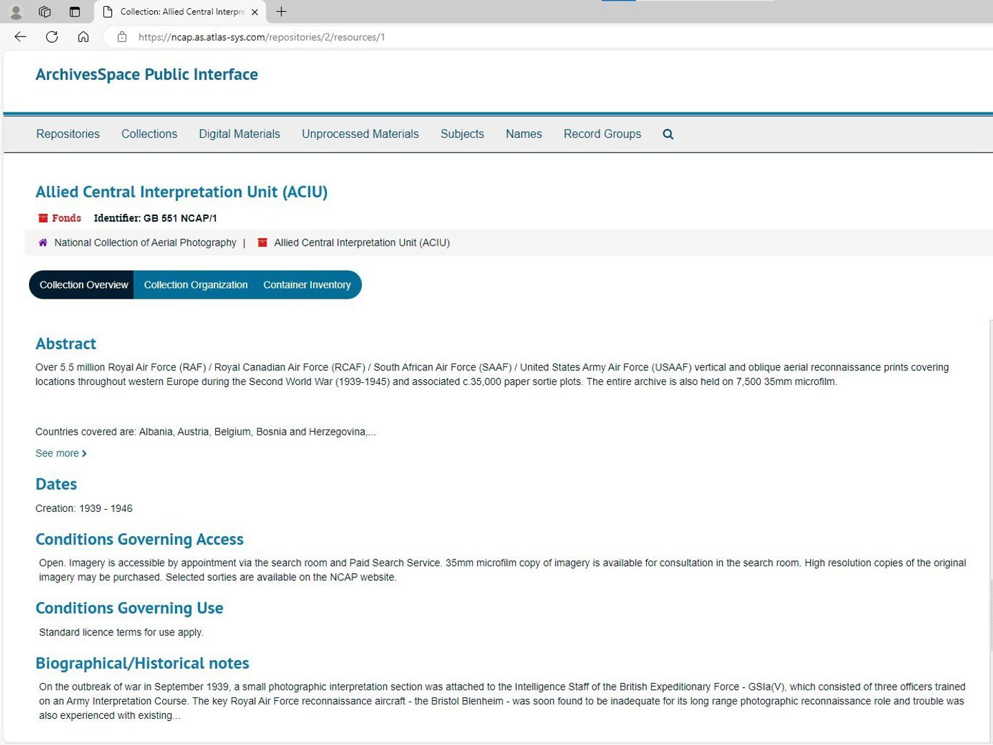
Collections level information
Researchers looking for information beyond the content of visual imagery, archive level descriptions are available through ArchivesSpace. Following archive sector standard cataloguing (ISAD-G) practices, we aim to facilitate access to academic research wherever possible.
Bespoke research access
Additionally, a Paid Image Search service is available for undigitised imagery. If you are still looking for some assistance, our team is able to help you with a bespoke research request.
Visitors are also able to access post-1945 Scottish aerial photography and 1939-1945 Western European imagery in print or microfilm format in the Search Room. Please note that hard-copy prints are not provided for digitally available images.
Related reading
IN THIS SECTION

Collections Care
Making sure photographic collections are cleaned and stable before any scanning has started underpins all work at NCAP.

Digital Imaging
Using the latest scanning technology, skilled technicians and robotic systems NCAP operates a highly productive digitisation facility.

Data Management
At peak efficiency, NCAP creates terabytes of data a day which needs to be managed, transferred and secured for long-term preservation.