Online Sources of Aerial Photography
England, Wales and Northern Ireland aerial photography
The following links are to other organisations holding aerial photography of England, Wales and Northern Ireland:
CRAPW: See the attached file for information about the Central Register of Aerial Photographs for Wales (CRAPW). For more imagery of Wales see RCAHMW.
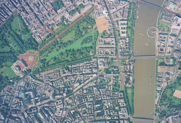
Historic England Archive (link is external): The Historic England Archive holds the largest public archive of aerial photography covering England.
RCAHMW (link is external): The National Monuments Record of Wales (NMRW) holds a major public archive of aerial photography of Wales. For more photography of Wales see CRAPW.
PRONI (link is external): The Public Records of Northern Ireland (PRONI) holds the largest public archive of aerial photography of Northern Ireland. For more information about their holdings please search the PRONI eCatalogue using the PRONI Reference "AM".
CUCAP (link is external): The Cambridge University Collection of Aerial Photographs (CUCAP) holds aerial photography created by the University since 1947 of locations throughout the United Kingdom.
Worldwide aerial photography
A selection of links are to other organisations holding aerial photography, or related records, of locations throughout the world.
CIGeoE (link is external): The Centro de Informacao Geoespacial do Exercito maintains the national archive of aerial photography of Portugal.
CUCAP (link is external): The Cambridge University Collection of Aerial Photographs (CUCAP) holds aerial photography created by the University since 1947 of locations across northern Europe.
Dutch Topographical Service (link is external): In addition to their own aerial photography, the Dutch Topographical Service holds Allied aerial photography (mainly of The Netherlands) from the Second World War.
Geoscience Australia (link is external): The Australian Government provides online access to its catalogue of flight line diagrams for aerial photography of Australia, Tonga and several Pacific island groups.
The Italian National Collection of Aerial Photography (link is external): This collection contains Allied / Axis aerial photography from the Second World War.
Imperial War Museum (link is external): The Photograph Archive at the Imperial War Museum holds the largest collection of British aerial photography from the First World War. It also holds selected aerial photography from the Second World War onwards.
Landmӕlingar Íslands (link is external) - The national mapping agency of Iceland holds aerial photography of the country from the 1940's onwards.
Lantmäteriet (link is external): The national mapping agency of Sweden holds aerial photography of the country from the late 1920's onwards.
The National Archives (link is external): Intelligence documents created using ACIU and JARIC aerial photography are held by The National Archives. It also holds much aerial photography, within records, that are not held by NCAP or other archives.
National Air Photo Library (link is external): Aerial photography of Canada from the 1920s onwards.
NARA (link is external): The Cartographical and Architectural Section of the United States National Archives & Records Administration (NARA) holds aerial photography of locations throughout the world. It holds Allied and Axis photography from the Second World War and postwar aerial and satellite imagery declassified by the United States Government.
National Geo-spatial Information (link is external): NGI holds an archive of aerial photography of South Africa dating from 1926-2008.
National Library of Australia (link is external): The Library holds a collection of aerial photographs of Australia, the Australian Antarctic Territory and Papua New Guinea dating from 1928 to 1987.
National Library of Denmark (link is external): The Royal Library holds 4 million vertical and oblique aerial photographs of Denmark and Faroe dating from 1921-2009.
Oxford University (link is external): The Commonwealth and African Aerial Photograph Archive holds a part copy of the Directorate of Overseas Surveys collection of aerial photography.
RAF Museum (link is external): The RAF Museum (London) Photograph Collection covers the history of British military aviation. It holds a number of small collections of aerial photography.
Smithsonian (link is external): The Smithsonian National Air & Space Museum in Washington DC has a permanent exhibition, Looking at Earth, devoted to the history and science of aerial and orbital imagery of the Earth.
Wageningen (link is external): The University of Wageningen Library holds Allied aerial photography (mainly of The Netherlands) created during the Second World War.
Wilfred Laurier University (link is external): Second World War aerial photographs of First Canadian Army's area of operations in western Europe.
Aerial photography and geospatial interest groups
AARG (link is external): The Aerial Archaeology Research Group (AARG) provides a forum for those involved in aerial photography, archaeology and landscape history.
British Cartographic Society (link is external): The British Cartographic Society (BCS) promotes cartography to a wide range of users.
Charles Close Society (link is external): The Society publishes articles on the Ordnance Survey and related topics.
DSA (link is external): The Defence Surveyors Association (DSA) maintains a liaison between serving / retired personnel who have worked in the UK defence domain where the focus is environmental information, hydrographic, oceanographic and geographic surveys, locating and target acquisition, navigation, and geospatial intelligence.
Medmenham Association & Collection (link is external): The Medmenham Association (formerly known as the Medmenham Club) was established in 1946 to maintain the camaraderie enjoyed by the photographic interpreters (PIs) who served in the Allied Central Interpretation Unit (ACIU) at RAF Medmenham during the Second World War.
Archives networks & catalogues
You can search for other organisations holding aerial photography, and related records, using the following online databases:
Discovery (link is external): Discovery provides access to catalogues describing archives held in England and Wales and information on the nature and location of historical records that relate to British history.
Archives Hub (link is external): This provides access to catalogues describing archives held by UK Universities and Colleges.
ARCHON (link is external): The ARCHON Directory is held by The National Archives. It includes contact details for record repositories in the United Kingdom.
NRAS (link is external): The National Register of Archives for Scotland (NRAS) is held by the National Archives of Scotland. It contains information on records in private hands and private papers deposited in Scottish libraries and museums.
SCAN (link is external): The Scottish Archives Network (SCAN) online catalogue allows you to obtain information about collections of historical records throughout Scotland.
Resources
CIA World Factbook (link is external): The Central Intelligence Agency (CIA) World Factbook provides useful reference maps of countries throughout the world.
Geoportail (link is external): An internet portal where georeferenced information data and services provided by national organisations in France can be accessed and viewed.
Ordnance Survey (link is external): The national mapping agency in Great Britain. The Ordnance Survey (OS) is the key source of accurate and current geographic data.
USGS EarthExplorer (link is external): The United States Geological Survey (USGS) EarthExplorer allows users to search for different types of aerial and satellite imagery of locations throughout the world.
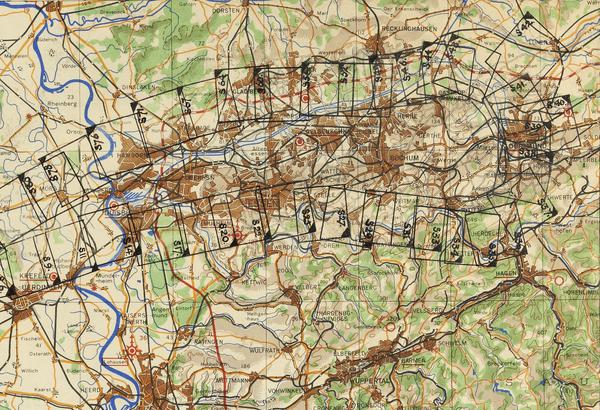
Historical military maps
Much of the declassified aerial imagery at NCAP was used to create military maps. The mapping supported military operations and provided a means to geo-catalogue aerial imagery. The following links are to organisations holding this mapping:
Cambridge University (link is external): The Map Room at the University Library allows access to British GSGS military mapping released by the UK Ministry of Defence.
McMaster University (link is external): Online access to British GSGS and US Army Map Service maps of Europe, courtesy of McMaster University Library.
National Library of Scotland (link is external): The Map Library at the National Library of Scotland (NLS) allows access to British GSGS military mapping released by the UK Ministry of Defence.
National Library of Wales (link is external): The Map Library at the National Library of Wales (NLW) allows access to British GSGS military mapping released by the UK Ministry of Defence.
Oxford University (link is external): The Map Room at the Bodleian Library allows access to British GSGS military mapping released by the UK Ministry of Defence.
Royal Geographical Society (link is external): The Foyle Reading Room allows access to some British GSGS military mapping released by the UK Ministry of Defence.
US Library of Congress (link is external): The Geography and Map Reading Room allows access to AMS military mapping released by the US Government.
British Library (link is external): The British Library holds the War Office archive of military maps.
Geospatial intelligence agencies
NCGI (link is external): The National Centre for Geospatial Intelligence, formerly known as the Defence Intelligence Fusion Centre, and the Joint Air Reconnaissance Intelligence Centre (JARIC), provides the British Government with geospatial intelligence from aerial imagery and other sources, in support of defence and national interests. The majority of imagery held by NCAP was declassified and released by the UK Ministry of Defence from JARIC.
DIGO (link is external): The Defence Imagery and Geospatial Organisation (DIGO) provides the Australian Government with geospatial intelligence, from aerial imagery and other sources, in support of defence and national interests.
NGA (link is external): The National Geospatial-Intelligence Agency (NGA) provides the United States Government with geospatial intelligence, from aerial imagery and other sources, in support of defence and national interests.
Online virtual globes
The following links are to online virtual globes. These can be used to create kml polygons required from customers requesting a Paid Search.
Bing Maps (link is external): A web based virtual globe owned and developed by Microsoft. The 'birds eye' feature provides access to oblique imagery.
Google Earth (link is external): A virtual globe owned and developed by Google for use on multiple platforms. The release of Google Earth in 2005 prompted a growing public interest in geospatial technologies and applications.
NASA World Wind (link is external): An open source virtual globe developed by NASA for use on PCs running Microsoft Windows. The programme provides access to NASA and USGS satellite imagery, aerial imagery, topographic maps and publicly available GIS data.
IN THIS SECTION
Case Studies
Explore the many new ways historical aerial imagery is being used today.
How-To Guides
Use the step by step guides to help you navigate some of the key tools from the NCAP archive.

Understanding Technical Terms
A glossary of some common technical terms associated with aerial photography.

FAQs
Find answers to some of the most common questions asked of the NCAP team.

Contact Us
Find the best ways to get in touch with the team at NCAP for research support, project partnerships or image sales.
Subscriptions
Subscriptions allow you to zoom images on the website and access finding aids to help identify images.