Explosive Ordnance Disposal
The National Collection of Aerial Photography (NCAP) holds vital imagery used by Explosive Ordnance Disposal (EOD) specialists who assess, manage and mitigate the risks posed by unexploded ordnance (UXO) in post-conflict regions around the globe.
Remnants of Conflict
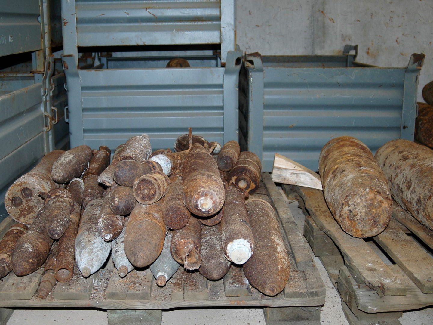
NCAP imagery plays a key role in supporting the Explosive Ordnance Disposal (EOD) sector as it manages the risks associated with unexploded ordnance (UXO) still buried decades after the end of conflicts. This is currently the most significant application of NCAP imagery. Arguably, it stands as the most critical use of our collections, given its indispensable role in ensuring human safety on construction sites throughout Europe.
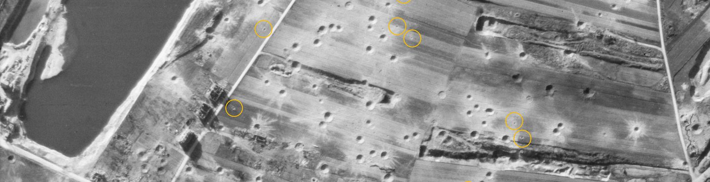
The historical context for this mission dates back to the Second World War when Allied forces dropped nearly 2.7 million tonnes of bombs on German and European targets. Post-war estimates indicate that approximately 12% of these munitions failed to explode on impact. As Europe began its reconstruction almost immediately after the war, thousands of tonnes of unexploded bombs were left buried in the ground and under water. Decades later, many of these hidden devices are being inadvertently discovered during land redevelopment, posing a significant threat to human life and safety. NCAP supports this effort by providing access to aerial photographs taken by sorties flown after each bombing mission, helping to locate and identify UXO sites so they can be safely removed.
Life-saving Imagery
To locate and neutralize these hazardous remnants of war, EOD specialists rely on high-resolution digital copies of aerial reconnaissance photographs. After bombing runs, sorties were flown to document the effectiveness of the missions. Exploded bombs leave circular craters, while unexploded bombs create bomb-shaped impressions in the ground. These photographs provide crucial historical documentation and intelligence, aiding in the identification of areas where UXO may be concealed. By carefully studying these high-resolution images which are geospatially located to a high degree of accuracy, EOD teams can accurately assess possible locations of unexploded ordnance, enabling safe extraction from the ground.
This information is invaluable and life-saving for site workers and local communities. It is part of NCAP’s core mission to provide long-term access to this imagery as long as it remains necessary.
How to access imagery
There are two ways to order NCAP imagery;
- Visit the Air Photo Finder which provides easy access to previously digitised imagery that is ready to order at optimal resolution.
Air Photo Finder
- NCAP offers a Scan-on-Demand Service where you can identify specific new images for digitisation by using Finding Aids where available. See the How-To Guides for help using the Finding Aids and ordering imagery.
How-To Guides Scan on Demand
More Case Studies

Missing in Action
Aerial imagery can be a vital tool for locating the remains of service personnel killed during military action or while serving as prisoners of war.

Creative Uses
From D-Day to the hunt for secret German weapons, the creative industry has used NCAP imagery to provide authenticity to their productions.

Boundary Disputes
Spanning 100 years, NCAP's aerial photographs can be vital tools in litigation, providing the crucial detail needed to prove property boundaries and rights of way.

Land-use Change
Monitoring and analysing changes in land use is an essential part of planning for a sustainable future and is a commercial, political and technical challenge.

Police Investigation
NCAP aerial photography has long been used by Police Scotland in investigations and when reviewing cold cases to assess landscape changes.