Land-use Change
The extensive range of historical aerial photographs held by the National Collection of Aerial Photography (NCAP) can aid in analysis of past land uses which might have an environmental impact on sites today and in the future.
Planning for a sustainable future
Monitoring and analysing changes in land use is an essential part of planning for a sustainable future and is a commercial, political and technical challenge. In recent years, much contemporary satellite data and aerial photography has been used to undertake these studies. However, when historical spatial information is needed, historic aerial reconnaissance photographs such as those supplied by NCAP are often the only available resource.
Our extensive range of historical aerial photographs, dating back to the 1920s, can aid in analysis of past land use practices which could have an environmental impact on a site today. The cost of procuring and analysing historical aerial photography is much less than the cost of unforeseen ground conditions and claims.
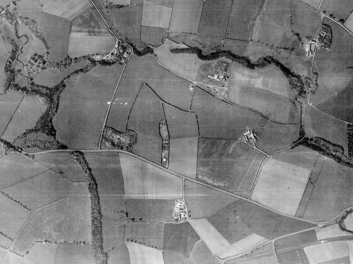
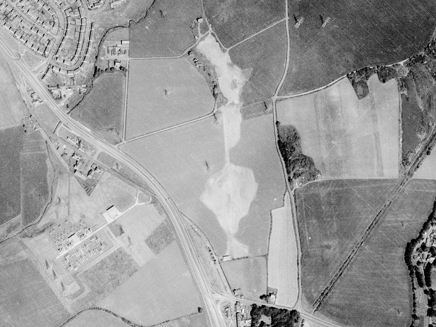
Fields outside East Kilbride; Collection: Scottish Office APU, Sortie: 106G/SCOT/UK/0084, Frame: 3051 (10 May 1946)
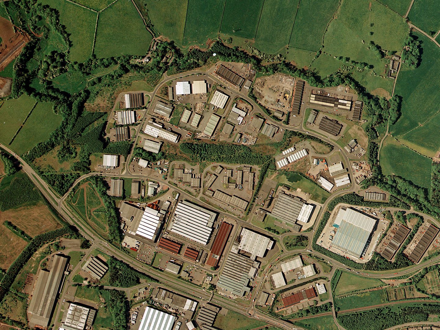
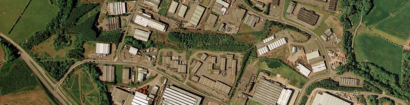
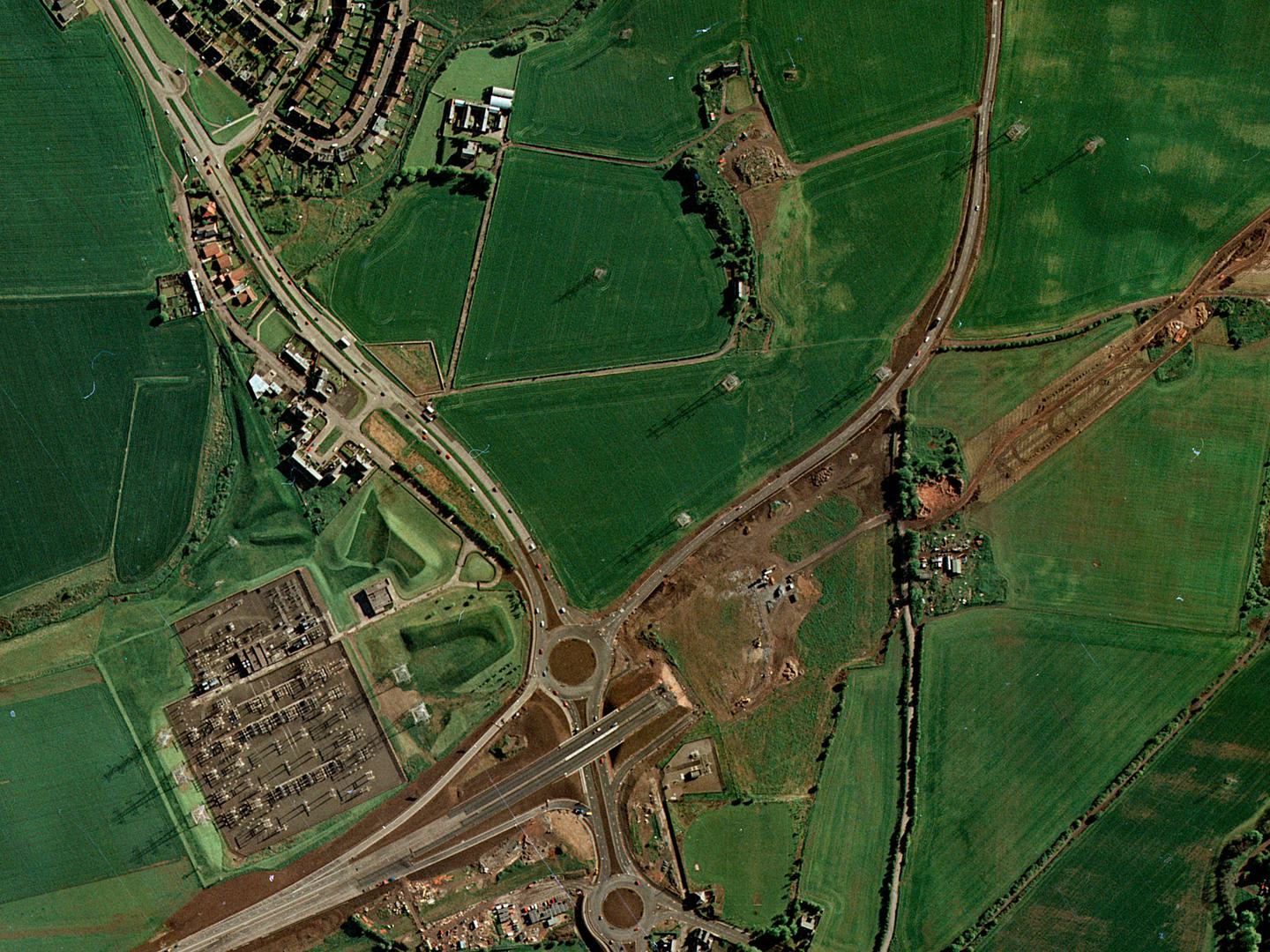
An industrial estate built over fields outside East Kilbride; Collection: Scottish Office APU, Sortie: ASS/51388, Frame: 0037 (10 June 1988)
Quarries and mines
For brownfield sites, aerial photographs are often the only evidence for features that will affect site development. The original excavation depth of landfill sites can be calculated. Physical features such as building foundations, slurry ponds and chemical tanks may be located on early aerial photography.
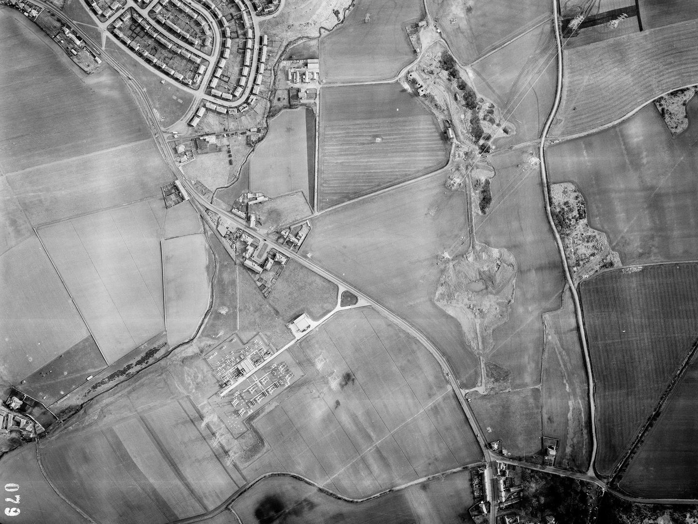
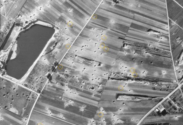
Burdiehouse, Edinburgh, with the three kilns of the lime works visible next to extensive excavations just above centre; Collection: Scottish Office APU, Sortie: MER/026/65, Frame: 0079 (09 April 1965)
Abandoned excavation sites, such as quarries and mines, often become dumping grounds for the fly-tipping of unwanted materials. Objects not normally documented, such as chemical drums, old tyres, vehicles and concrete rubble may be observed on aerial photography.
Burdiehouse, Edinburgh, with the three kilns still visible but the excavations filled in; Collection: Scottish Office APU, Sortie: MER/112/71, Frame: 0105 (10 July 1971)
When multiple instances of cover are available, the type, age and thickness of fills can be identified and located.
Knowing the location and type of buried physical obstructions and chemical residues allows specific problems to be better defined. Resources can then be allocated for targeted remediation ahead of new construction projects.
Burdiehouse, Edinburgh with the three kilns are still visible. Fields and a new road now cover the old excavations; Collection: Scottish Office APU, Sortie: ASS/50888, Frame: 0081 (27 May 1988)
How to access imagery
There are two ways to order NCAP imagery;
- Visit the Air Photo Finder which provides easy access to previously digitised imagery that is ready to order at optimal resolution.
Air Photo Finder
- NCAP offers a Scan-on-Demand Service where you can identify specific new images for digitisation by using Finding Aids where available. See the How-To Guides for help using the Finding Aids and ordering imagery.
How-To Guides Scan on Demand
More Case Studies

Missing in Action
Aerial imagery can be a vital tool for locating the remains of service personnel killed during military action or while serving as prisoners of war.

Creative Uses
From D-Day to the hunt for secret German weapons, the creative industry has used NCAP imagery to provide authenticity to their productions.
Explosive Ordnance Disposal
NCAP imagery is used by Explosive Ordnance Disposal specialists to manage and mitigate the risks posed by unexploded ordnance.
Boundary Disputes
Spanning 100 years, NCAP's aerial photographs can be vital tools in litigation, providing the crucial detail needed to prove property boundaries and rights of way.
Police Investigation
NCAP aerial photography has long been used by Police Scotland in investigations and when reviewing cold cases to assess landscape changes.